Admiralty Point – Table of Contents
- Hike Introduction
- Hike Statistics
- Map and Elevation
- Admiralty Point Video
- Hiking Route Description
- Directions and Parking
- Free PDF Download
Admiralty Point Hike Intro
Admiralty Point Trail, near Belcarra Regional Park, is an easy and peaceful hike. The trail has minimal elevation change, making it a great choice for families. As a sea-level hike, it’s also a nice hike to do in the shoulder seasons when other hiking trails are covered in snow.
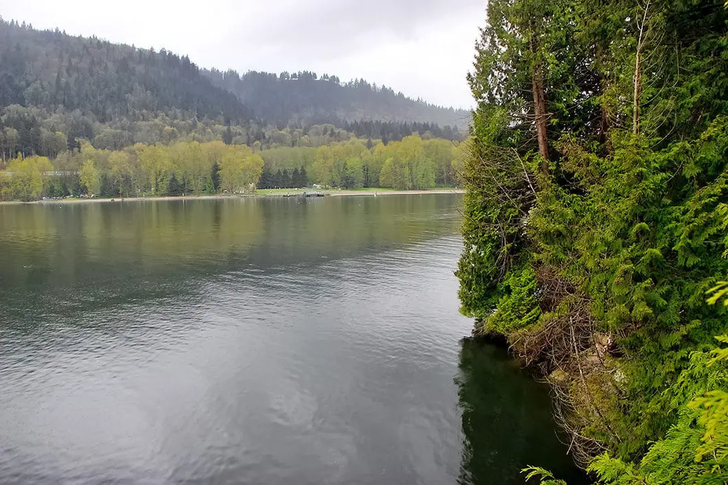
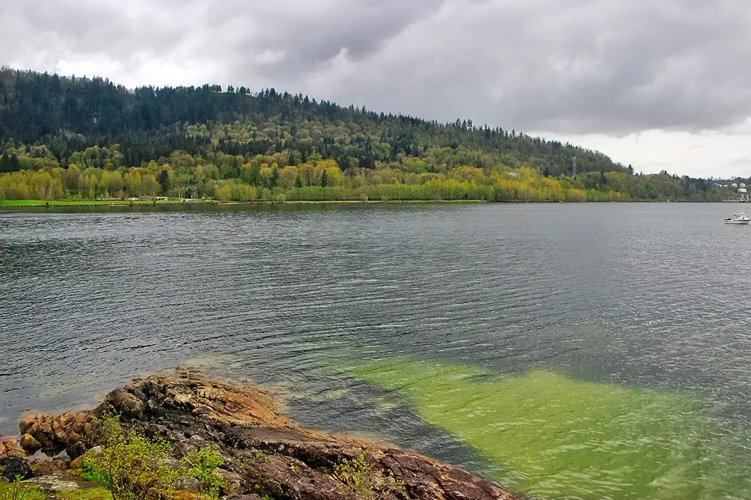
The main attraction of the Admiralty Point Trail is, not surprisingly Admiralty Point itself. Admiralty Point offers a great view of the North Shore (Mount Seymour and Deep Cove), the Indian Arm, Burrard Inlet, and Burnaby Mountain.
It is 2 km to reach Admiralty Point from the parking lot. From Admiralty Point, the trail continues another 1 km to Burns Point, which offers a nice view across the Burrard Inlet to the Barnet Marine Park.
The hike also offers a few quick detours to Cod Rock and Maple Beach, which are well worth it.
Making all the stops and hiking to Burns Point makes for a pleasant 6 km trek.
Admiralty Point Hike Stats
Rating: Easy
Distance: 6 km
Net Elevation Change*: 50 m
Highest Point: 52 m
Time Needed: 2.5 Hours
Type: Out-and-back
Season: Year-round
Dogs Allowed: Yes, on leash
Est. Driving Time from Vancouver: 50 Minutes
Trailhead Coordinates: 49.312126, -122.925700
*For a better understanding of the stats and difficulty rating, check out the Hiking Guides page for details. Always carry The Essentials and fill out a trip plan.
Admiralty Point Video
Here is a 2-minute video of our experience on this hike!
Admiralty Point Hike Map and Elevation
Admiralty Point
Profile
Admiralty Point Hiking Route
Belcarra Regional Park has a picnic area with fire pit and is a busy gathering spot in the summer. The park has two main hiking trails, Jug Island Beach Trail and Admiralty Point Trail.
From the main parking lot, you will see an open field and a dock on the water. Down near the shore, to your left, there are restrooms. The Admiralty Point Trail begins near the restrooms. From the restrooms, follow the sign for the Springboard Trail. Very soon after, you’ll see another sign directing you to Admiralty Point Trail. This is a wide, gravel trail.
After a short way, you will come to another junction on your left. There is a trail marker here. Follow the trail up, into the forest, in the direction marked for Admiralty Point. If you were to continue straight, on the gravel path, you would end up at a house.
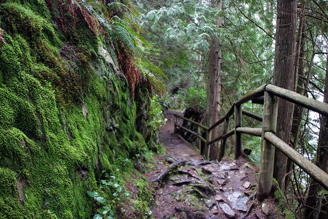
Climb up the small hill and you will soon see the house down to your right, through the trees. The trail then narrows and begins to drop back down.

Continue to follow the trail as it winds its way along. The trail is easy to follow and you’ll see the ocean to your right through the trees. At 1 km, you’ll come to Cod Rock. There is a Parks Canada sign and a junction marked for Cod Rock. Go to your right, and enjoy the lookout from the rocky outcrop.
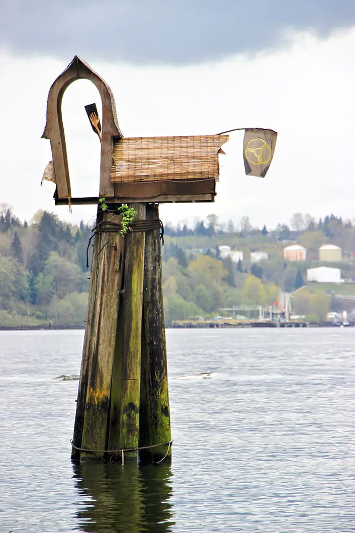
Leave Cod Rock, and carry along the trail again for another fifteen minutes. Next, you will come to Maple Beach. There is an outhouse on the other side of the main trail where it drops down to the beach. Maple Beach is a nice beach full of pebbles and is a great place to take a break or have lunch. Maple Beach is roughly 1.8 km into the hike. There is a unique birdhouse just off the shore, and a nice view over to Burnaby and the North Shore.

From Maple Beach, it’s a quick two-minute walk to the junction for Admiralty Point and Burns Point. When you reach the junction, go right in the direction marked for Admiralty Point. From the junction, it’s 100 m to reach Admiralty Point. This junction is about 1.9 km into the hike.
Once you walk onto Admiralty Point, you’ll have your best view of the day. You can see across the Burrard Inlet to Burnaby Mountain. Up the Burrard Inlet, you will find the Second Narrows Bridge and, on a clear day, downtown Vancouver. You can see Cates Park and Mount Seymour off to your right. And further right, you can see the entrance to Deep Cove and a short way up the Indian Arm.
Cool fact: Admiralty Point Park is its own park, separate from Belcarra Regional Park, and is maintained by Parks Canada. The federal government signed a 99-year lease with the City of Vancouver in 1912 to keep the land for parks purposes. The lands were then handed over to Metro Vancouver until the lease ran out in 2011. There were talks about possible development on the land. Luckily in 2014, the federal government announced that Admiralty Point would be preserved as a public park. The federal government has pledged $100,000 annually to maintain the park. “The lands also play a part in Port Moody’s history. Col. R.C. Moody, for whom the city of Port Moody is named, established the Admiralty Point Military Reserve there in 1860.”[Vancouver Sun]

After leaving Admiralty Point, head back to the junction for Burns Point. Go right, in the direction marked for Burns Point. It is almost exactly 1 km to reach Burns Point from here. The trail is very similar, although it becomes a little more rugged and rooty. In the spring, there may be more mud here than the earlier sections of the trail.
At 2.5 km into the hike (halfway between Admiralty Point and Burns Point) there is a wooden bridge crossing a stream. After the bridge, you will go up a short flight of wooden stairs.
Eventually, the trail drops down and reaches Burns Point. It’s 3 km total to reach the Burns Point lookout. From here, you can see across the Port Moody Arm to the Barnet Marine Park. You will also see boats coming in and out of Rocky Point to your left. If you’re lucky, you might spot a harbour seal down in the water below you.
Watch your step on this cliff and stay away from the edge.
When you’re ready to return, simply retrace your steps along the trail. You can head straight back to the parking lot, or detour to any of the lookout spots you passed on the journey out.
If you want to do more hiking, Jug Island Beach is another great hike starting from the Belcarra Park parking lot of similar difficulty.
Download the PDF version of this guide for offline use
Directions and Parking
From the Barnet Hwy/ St. Johns Street in Port Moody, take Ioco Road north. Follow Ioco to the left at the intersection with Heritage Mountain Boulevard. Ioco Road will climb up alongside Rocky Point. In about 4 km turn right onto 1st Ave. Follow 1st Ave left at the first junction, as it turns into Bedwell Bay Road. Follow Bedwell Bay Road and then turn left onto Tum Tumay Whueton Dr.. Follow Tum Tumay Whueton Dr. all the way to the parking lot at the shore. There will be signs for Belcarra Regional Park along the final stretch of the drive.
Google Map directions are here.
Pay attention to the park hours. In the winter months the gates close early!
Other great hikes in this area
- Jug Island (moderate)
- Sendero Diez Vistas (moderate)
- Sugar Mountain (moderate)
- Belcarra Bluffs (moderate)
- View all hiking guides here


