Brunswick Mountain – Table of Contents
- Hike Introduction
- Hike Statistics
- Brunswick Mountain Video
- Map and Elevation
- Hiking Route Description
- Directions and Parking
- 360° Photosphere
- Free PDF Download
Brunswick Mountain Hike Intro
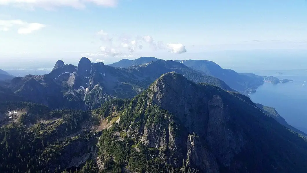
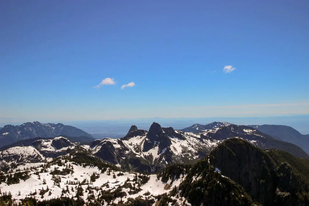
Brunswick Mountain is the highest of all the North Shore peaks, and as such has incredible views in all directions. Howe Sound and its islands, Brunswick Lake, Sky Pilot Mountain, The Lions, Mount Harvey, and Grouse Mountain are all prominently on display. The narrow summit has a 360 degree panoramic view that is truly one of the best around.
However, the hike to the summit is not for the faint of heart (or for the inexperienced hiker, for that matter). The final 200 m are very steep and exposed, and require some scrambling. Weather can set in quickly, and if there’s snow or ice you must take extreme caution. The ridge approaching the summit is very narrow and a slip at the wrong moment could easily spell disaster.
But, if you can handle the vertigo, Brunswick Mountain is the perfect hike for anyone looking for something challenging, with lots of vertical climbing and jaw-dropping views.
Warning
This hike is among the more difficult of all the day hikes around southwest British Columbia. This guide is not intended for beginner or new hikers. Please make sure you are in good fitness and take all regular safety precautions on this hike.
Brunswick Mountain Hike Stats
Rating: Difficult
Distance: 14 km
Net Elevation Change*: 1,543 m
Highest Point: 1,788 m
Time Needed: 7 – 9 Hours
Type: Out-and-back
Season: June to October
Dog Allowed: Yes
Est. Driving Time from Vancouver: 40 minutes
Trailhead Coordinates: 49.470711, -123.234789
*For a better understanding of the stats and difficulty rating, check out the Hiking Guides page for details. Always carry The Essentials and fill out a trip plan.
Brunswick Mountain Hike Video
Here is a 3-minute video of our experience on this hike!
Brunswick Hike Map and Elevation
Brunswick Mountain
Profile
Brunswick Mountain Hiking Route
The hike to Brunswick Mountain starts along the same gravel road as the popular hike to The Lions. From the end of Sunset Drive, walk past the gate and onto the wide, gravel road. Follow the road as it zig zags and climbs gradually uphill. Within a few minutes you will pass by a concrete structure on your right. After 1 km, or about 15 minutes of hiking, you will come to a metal fence, where the trail splits off on your right, onto a narrower path.
Take the path, uphill, now at a steeper grade for another kilometer. At the 2 km point (roughly 30 total minutes), you will reach another split in the trail. Going right is marked (by a colorfully painted sign) as the route towards The Lions. Go left, onto the skinny single-track trail, which is marked towards Brunswick Mountain. The trail here is relatively flat for the next 700 m.
You will quickly reach a small creek crossing, followed by a larger creek. The larger crossing is over Magnesia Creek and there should be a makeshift log-bridge with a rope handrail to carry you over. The trail picks up on the other side, marked by orange flagging.
Beyond Magnesia Creek you will come to a junction where going straight is marked for Hat Mountain and Tunnel Bluffs. Go right, heading uphill onto an old, severely overgrown road.
Cool fact: Brunswick Mountain is the highest peak on the North Shore. Also, the “name comes from the H.M.S Brunswick, one of the ships that fought on “the Glorious First of June” 1794, a battle between the British and the French”. [source]
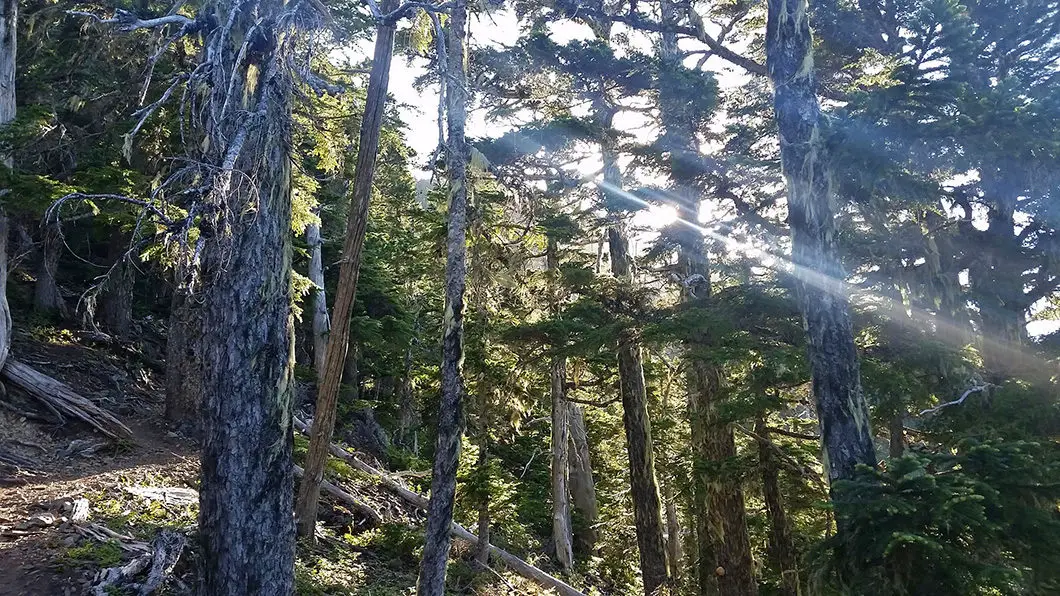
The trail will begin climbing upwards again, at about a 15% grade. The trail becomes quite narrow and can be overgrown in sections. Follow the trail as it switchbacks several times. Just shy of the 5 km mark into the hike, some partial views of Howe Sound will open up through the trees onto your right. After this point, the trail becomes very steep, and will remain so for the rest of the hike to the summit of Brunswick Mountain. Once you reach 1,100 m elevation you will enter into old-growth forest.
After roughly 1.5 – 2 hours of hiking, at the roughly 5.5 km mark you will come to a nice, open viewpoint of Howe Sound. And just a few minutes further along the trail you will get your first view of Mount Harvey to your right through a break in the trees. You are roughly at 1,400 m elevation here, with about 400 m of climbing to go. Tough climbing.
It’s not far to go until you reach the junction for the Howe Sound Crest Trail. When you hit the Howe Sound Crest Trail junction keep going straight up in the direction marked for Brunswick Mountain. Going left or right takes you along the Howe Sound Crest Trail itself – a phenomenal, but challenging hike to complete another day. To the left would take you towards Brunswick Lake (and ultimately Deeks Lake and then Porteau Cove). Going right would take you to Magnesia Meadows (and ultimately to The Lions, St. Mark’s Summit, and Cypress Bowl).
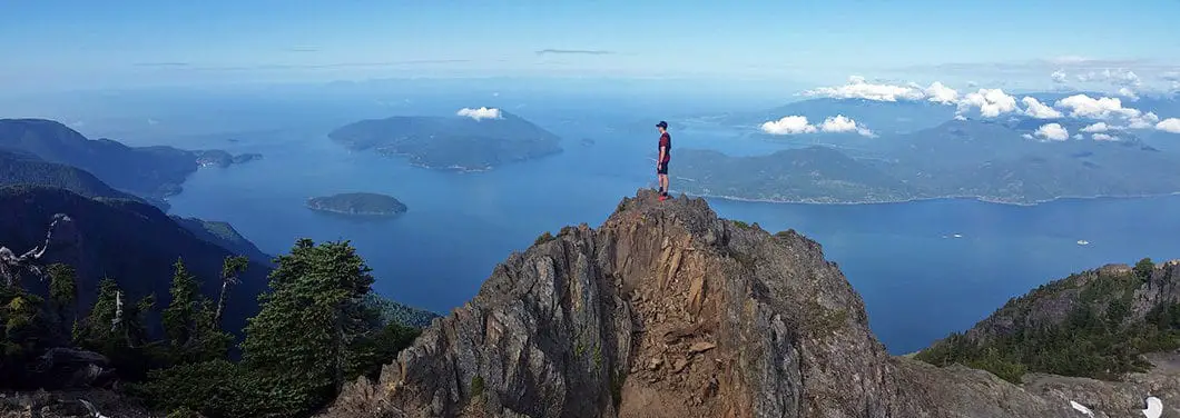
The summit is not far from here, but the toughest hiking of the day remains. Exposed rock and some technical scrambling awaits. There is no clear route in sections, other than the occasional orange spray-paint markings on the rocks. Some sections require hands for scrambling up, and you’ll want to be careful here if you have tired legs. Take your time and remember to look behind you once in a while, as the view is amazing, even from here.
Weather can also pose a challenge on Brunswick Mountain due to its elevation. Weather can set in quickly, making it difficult to find you way around the summit area. If there is any snow or ice you will want to be extremely cautious.
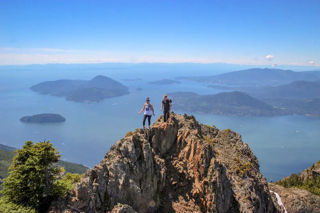
Slowly plug away at the elevation and after some effort you will reach the saddle which leads to the Brunswick Mountain summit. The ridge is very exposed and requires much caution – this is what is called a ‘no-fall zone’, for obvious reasons. The steep drops off the ridge would be unforgiving. You will pass a wooden helicopter landing pad along the ridge just before reaching the summit.
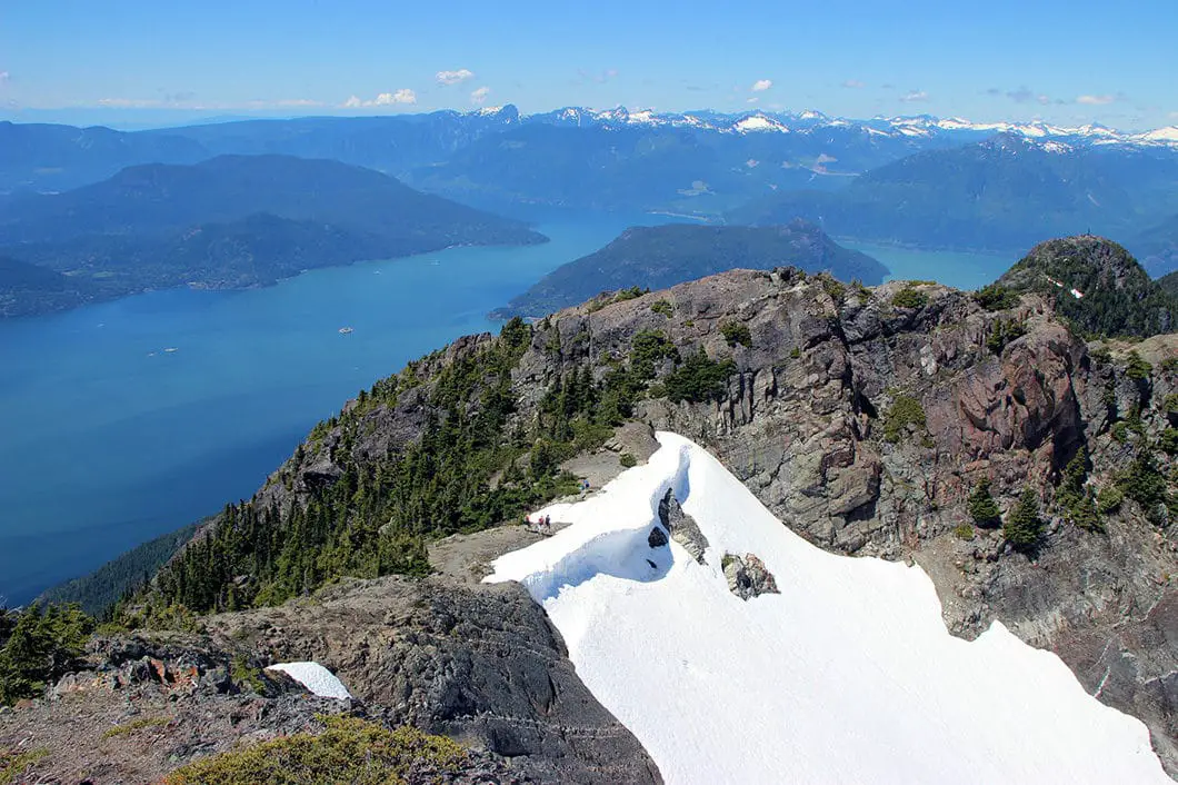
The summit view, however, is unbeatable, and will make you forget about tired legs. You can see Mount Harvey, The Lions, Mount Unnecessary, Crown Mountain, Grouse Mountain, Howe Sound and its islands, Vancouver Island, Sky Pilot Mountain, Brunswick Lake, James Peak, Hat Peak, Mount Hanover, Magnesia Meadow… and more. A lot more. Its a breathtaking sight you have to see for yourself. It’s an amazing feeling to be looking DOWN onto The Lions.
You’ll notice the ridge carries on and you could access the eastern peak of Brunswick Mountain. While possible, the risk/reward isn’t worth it. The risk of falling vs the reward of a view that isn’t any better than the one you can enjoy from the west peak.
To return, retrace your steps. It’s also possible to exit via either way along the Howe Sound Crest Trail with some more planning and a second car.
Download the PDF version of this guide for offline use
Driving Directions and Parking
Go north on Highway #99 towards the town of Lions Bay and take The Oceanview Road exit. Then turn left onto Cross Creek Road, followed by a right turn on Centre Road, a left on Bayview Road, left on Mountain Drive, and left on Sunset Drive and park near the gate.
Take the Lions Bay Ave exit. Merge onto Oceanview Road and take a left onto Crosscreek Road. Take a right onto Center Road and a left onto Bayview Road. Follow Bayview Road all the way up to its end and turn left onto Sunset Drive. At the end of Sunset drive you will find a limited number (15) of pay-parking spots.
If parking is full, you’ll need to drive back down the road until you find a suitable parking spot east side of Mountain Drive or use the lower parking lot at the Lions Bay Elementary school.
Please refer to the Lions Bay website for the latest information on parking.
There are Google Map directions here.
Other great hikes in this Area
- Howe Sound Crest Trail (difficult)
- St. Mark’s Summit (moderate)
- The Lions (difficult)
- View all hiking guides here
360° Photosphere (click and drag to look around)
Download the PDF version of this guide for offline use


Dimo
Did this in probably the worst of conditions! Utilizng my Colonizer British accent and hiking it in Total fog/cloud cover! but it did clear up and there was alot of humor, yodelling and madness! For your viewing entertainment it’s all here in this vid! haha https://youtu.be/9RJVervFr3c
Friday
Yep…. I do love a great hike. Live in a housing co-op. Unfortunately… the people I know are not in any
condition to hike mountain trails. They are, for the most part…. more into the couch potato life-style…
Friday
Karl W
There are lots of clubs and meet-up groups around town were people get together and go for hikes. There’s a list of hiking groups/ clbus here: https://www.outdoorvancouver.ca/resources/outdoor-clubs/
I recommend Wanderung too, its an email-based call-out system where you can pick to join a ‘callout’ you are interested in and arrange car-pooling etc.
Good luck!