Coliseum Mountain – Table of Contents
- Hike Introduction
- Hike Statistics
- Coliseum Mountain Video
- Map and Elevation
- Hiking Route Description
- Directions and Parking
- Free PDF Download
Coliseum Mountain Hike Intro
Lynn Headwaters Backcountry Winter Closure
This hike and all backcountry routes at Lynn Headwaters Regional Park are now CLOSED due to hazardous winter conditions. This applies to routes beyond Norvan Falls (e.g. Hanes Valley, Coliseum Mountain and Lynn Lake) as well as routes in the Grouse subalpine (e.g. Dam Mountain, Thunderbird Ridge, Crown Mountain, Goat Mountain, Little Goat & Goat Ridge). See more from Metro Vancouver.
Unpredictable and rapidly changing hazardous mountain weather conditions may include:
– Snow, ice and slippery conditions in steep terrain
– Heavy rainfall
– Rock and ice fall
– Lack of visibility (whiteout caused by fog and/or snow)
– No trail markers
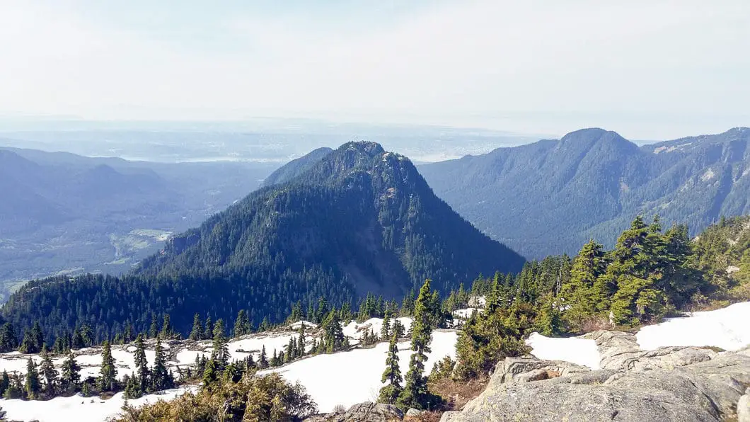
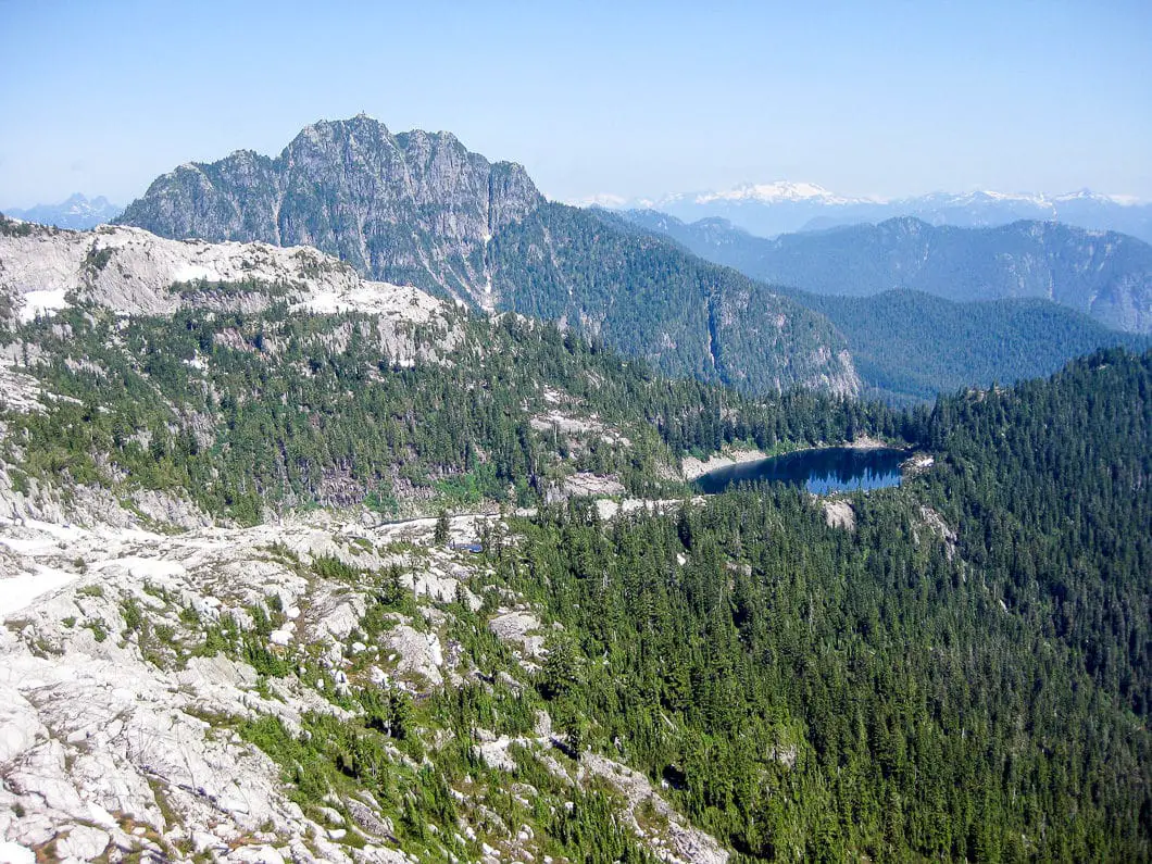
Coliseum Mountain is a challenging hike which offers a striking, panoramic view from its alpine summit. The summit offers views of Mount Burwell, Burwell Lake and Cathedral Mountain to the north. Mounts Seymour, Elsay and Bishop to the east. Mount Baker and the Lower Mainland to the south. Crown Mountain, Goat Mountain, Mount Fromme, and even Vancouver Island can be seen to the west.
At an elevation of 1,446 m, Coliseum Mountain is best tackled late in the summer when most of the snow has melted – August or early September is ideal. The hike begins at Lynn Headwaters Regional Park and it is a solid 10 hour hike with plenty of elevation gain.
If you’re looking for an easier hike in the area, Lynn Peak or Norvan Falls are great options.
Coliseum Mountain Hike Stats
Rating: Difficult
Distance: 23.5 km
Net Elevation Change*: 1,245 m
Highest Point: 1,446 m
Time Needed: 8 – 10 hours
Type: Out-and-back
Season: July to October
Dogs Allowed: Yes
Est. Driving Time from Vancouver: 30 minutes
Trailhead Coordinates: 49.359619, -123.027950
*For a better understanding of the stats and difficulty rating, check out the Hiking Guides page for details. Always carry The Essentials and fill out a trip plan.
Coliseum Mountain Video
Here is a 3-minute video of our experience on this hike!
Coliseum Mountain Hike Map and Elevation
Coliseum Mountain
Profile
Coliseum Mountain Hiking Route
From the Lynn Headwaters trailhead you’ll follow the same route that takes you to Norvan Falls. Cross the bridge over Lynn Creek and head to the hiker registration station where you can fill out a form. From the registration station head left (upstream). For the next 6.8 km you’ll enjoy a nice flat hike alongside Lynn Creek on the well maintained Cedars Mill and Headwaters Trails. Don’t let the flat, wide trail fool you – the hike becomes much more challenging later on. The trail towards Norvan Falls is marked every 1 km from the hiker registration station.
Following the Cedars Mill Trail upstream Lynn Creek, you will reach a junction at 1.9 km marked for Headwaters Trail and Upper Lynn Loop. Ignore this junction and carry on north alongside Lynn Creek.
2.1 km further you will reach the Third Debris Chute. This wide open area is easily recognized by the green search and rescue cache, and open views of Mount Fromme and Goat Ridge to the west. The trail picks up again just above you – continue to follow north (upstream direction). From here, you have a couple of creek crossings and 3 km to reach the Coliseum Mountain junction.
About 800 m beyond the 6 km marker, you will reach the junction for Coliseum Mountain Trail, which is very well marked. Go right here (heading straight from here would take you to Norvan Falls or into Hanes Valley / Lynn Lake. Norvan Falls is worth the detour if you can spare 20 extra minutes). From this junction, the easy hiking is over and the trail becomes steep and challenging until you reach the sub-alpine. This is where the fun begins. The sign here says it is 7 hours return to Coliseum from this point. Fit hikers keeping a good pace should be able to make it considerably faster.
Follow the trail up alongside Norvan Creek, observing the square, yellow markers. The trail begins to climb immediately. The path is fairly well-worn, but in a few sections it can be hard to keep track of the trail as it climbs upwards, so just make sure you keep an eye out for the yellow markers, which are fairly frequent. You will hear Norvan Creek rumbling off to your left. Within an hour you’ll go over a few creek bed crossings. At the 8 km mark there is another small creek bed you can scramble down to Norvan Creek on your left. This is a chance to get some water or go for a quick cool-down on a hot day. It is also around this part of the hike, at elevation 750 m, where you will leave second growth forest and enter into old growth.
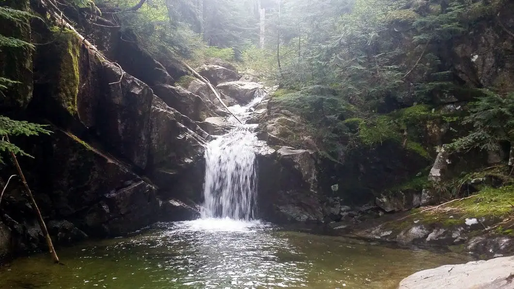
Continuing on, you will soon be entering into Norvan Meadows where there is an avalanche debris field and Lynn Ridge (The Needles) up above you. For this stretch of the hike, parts of the trail can be quite muddy and marshy, so gaiters might be a good idea. The trail flattens out a bit for this section, giving you a break from the steep climbing.
At 9.5 km you will cross over another creek and the trail will become steep again. This section of the trail is marked with orange flagging tape. At 10 km you will reach Norvan Pass in the subalpine. It will take about 3 – 4 hours to reach this point. The trail splits here, and to the right is a quick detour for a nice view of the Seymour Watershed. Here, there is also a bushwhacking route to The Needles which is unsafe and not recommended for hiking.
Pushing along back from the main trail and heading north, there are some short, narrow ascents/ scrambling sections that will require your hands to climb up. As you continue your climb towards Coliseum Mountain, you will get sections of views of Crown Mountain to the West, and Mount Seymour to the east.
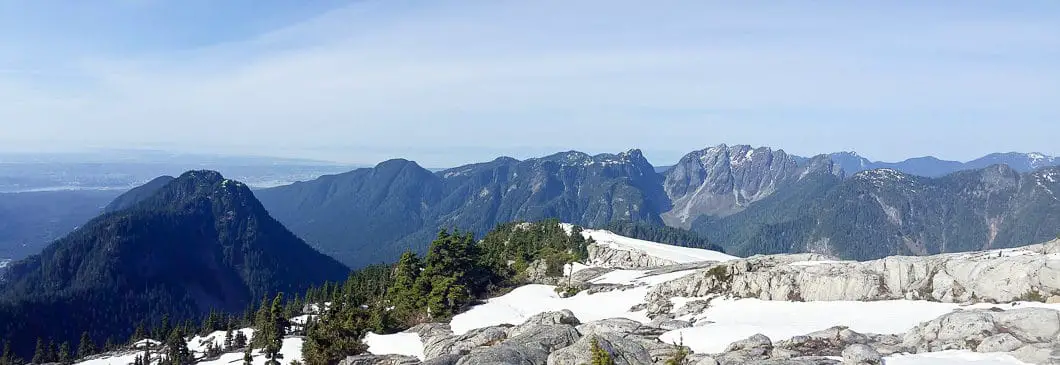
Within an hour of Norvan Pass, you should be in the alpine of Coliseum Mountain. The trail can be hard to follow as the alpine begins to open, but you should be able to follow the orange tape and cairns. Keep scrambling your way up to the top to enjoy the spectacular view. Immediately to the north you’ll see Mount Burwell, Cathedral Mountain and the mountains of Garibaldi Provincial Park off in the distance. Just west you’ll have a great view of Grouse Mountain, Goat Mountain, Crown Mountain, and Vancouver Island beyond. To the east you’ll see Mount Seymour, Mount Bishop, and south you’ll see the Lower Mainland and (on a clear day) Mount Baker. It’s a view that is hard to beat!
It is possible to carry on to the summit of Mount Burwell from here, but this will take another 2 hours total. Cathedral Mountain looks like an enticing challenge also, however, given it lies within the Seymour Watershed, it is off-limits to the public.
To return, retrace your steps.
Download the PDF version of this guide for offline use
Directions and Parking
From Highway #1 West take the Lynn Valley Road (exit #19 north) in North Vancouver. Follow Lynn Valley Road all the way up into the Lynn Headwaters Regional Park parking lots. The gate hours vary with the season so make sure you’re aware of the closing time.
Click here for Google Maps directions.
Help Us Create New Hiking Guides!
Advertising revenue is falling quickly across the internet, and independently-run sites like Outdoor Vancouver are hit hardest by it. We are committed to keeping Outdoor Vancouver free and independent, but we need to find other ways to continue operating this site.
If you like our hiking guides and would like to help, please consider making a contribution with the PayPal or Patreon links below – any amount helps! There is also a list of other ways you can support Outdoor Vancouver here!
Becoming a Patron through Patreon unlocks membership benefits and rewards. Learn More.
A one-time donation through PayPal helps with monthly website hosting costs.
Other great hikes in this area
- Hiking South Needle (difficult)
- Lynn Peak Hike (moderate)
- Hanes Valley Loop (difficult)
- Hiking Norvan Falls (moderate)
- View all hiking guides here




karim
I have a rather large dog, about 95 lbs. Has anyone taken a large dog there. He is quite agile but if there are sections where i have to lift, then it won’t work. i have been wanting to do the coliseum for a very long time. every time i see the flat surface and most of the time snow covered, i add it to my bucket list for the season but it is left in the bucket over the winter. Also, while i appreciate the comments, sometimes people really make a particular hike sound a lot harder than it actually is. would be great to do a comparison to a known trail such as the grouse grind. I did the west lion trail the other day and was surprised as to how easy it was. It is long but not really challenging. most of the review would have the first word “challenging”. Now, climbing the actual west lion summit which i was too much of a chicken to do, would be and is challenging!
Brian B.
Hiked to peak of Coliseum Mtn on Aug 28 with a friend, via Lynn Creek. Both of us are in decent shape and have considerable hiking experience, but neither of us had done this hike before.Was a great hike but definitely one to prepare for. Once past Norvan falls the terrain changes and its mainly climbing from there on (steep and steeper). Most of the hike is treed so very few vistas, so not the most scenic trail. Had no problems following the trail as it is quite well marked. Unfortunately it was an overcast day and we had no view at the top. We were about 7.5 hours return with only about 20 minutes at the top. I would say you couldn’t go much faster unless you are running sections. Have checked this trail off the list and unlikely I will do it again. We contemplated riding our bikes to the 9km mark of seymour demo forest and attempting that route, to reduce the time to trailhead, but we wanted take our dogs which are not allowed in seymour demo forest. I much prefer the Hanes Valley hike to Coliseum.
Joyce
Hi! I just did the coliseum yesterday and it was really challenging for me, the terrain was really bad! I was thinking about doing the Panorama in Whistler. Which one is more difficult?
Karl W
Hi Joyce,
They are both very difficult hikes. The trail itself to Panorama may be a bit more groomed, but its a very long hike at 30km, and the final few kms are steep and rocky. I don’t think Panorama is a good hike if you didn’t enjoy the difficulty of Coliseum. You can try camping up in Garibaldi Park if you wish to split the hike into two days, which may make it more manageable. Hope that helps.
Vanessa
Hi there! I was wondering if anyone has camped up there overnight. If so, could you please tell me if water in the small lake is drinkable and how cold it gets there at night. Thanks.
Ryan M
This is a strenuous hike with 1200 meters of elevation gain from headwaters parking lot. From Norvan falls the elevation gain is roughly 900-1000M. It is for the avid hiker with better than average fitness, and I would guess that most would throw the towel in after the first 30-40 minutes from Norvan. The trial kicks straight-up for about 400 meters from Norvan falls, with difficult footing, and hard to follow trail. It is flagged, and has trail markers. If wet, trekking poles are recommended. Think Grouse Grind with less high-stepping, and terrible and technical trail conditions. Once above the 1000M mark this trail opens up with good views, multiple creek crossings, and remains with technical trail conditions.
Be prepared for real scrambling sections above 1100 meters ( no rope need), once on the final ridge-line ascent, changing conditions, and again, a uphill grind. Once above tree-line this hike is well worth it, but again, getting there is no easy task. This trail is not heavily used, so be prepared when starting up this hike. I was 4 hours to summit, with little stoppage from the headwaters lot. Was little under 3.5 hours back to car at headwaters, with the need to be very cautious on the down climbing from the tree line back to Norvan.
Note: there are plenty of areas to filter water on the trail. I would not recommend this hike to anyone who is not in for a full day of hiking, is not adequately prepared with all trail essentials, and who is faint of heart. Also recommend you let the trail dry out a bit after a rainfall for at least 48 hours. During rain, this trail, with the seasonal run-off was flowing with water.
It isn’t necessarily a hike I would do more than once-just for fun. There was also no snow when this was competed. If you want to bag an easier peak, head to Lynn Peak instead.
Maria Christina
I just made it to Coliseum Mountain today.Registered @ Lynn Headwaters Park @ 7:45 AM and got back @ exactly 4 PM. Really great views @ the SUMMIT.
Karl W
Hey Oliver,
If you managed to tackle Coliseum, you’ll be fine for Crown as far as your fitness goes for sure. It it slightly more technical or exposed near the top for, but nothing too crazy. The true summit is indeed a tiny little point that I don’t recommend going on. If you don’t do that, you’ll be fine! So, yes, it is slightly ‘more risky’ but not much. Use your common judgement about what you should or shouldn’t be climbing up. I think you’ll really enjoy Crown!
Oliver
thanks for the reassurance!
I think I will do it before the snow starts to set in. It also looked hard on the Lynn Headwaters Regional Park trailhead map because the whole trail was colored as challenging as opposed to Coliseum or Hanes Valley. Only the boulder field on Hanes was listed as challenging as well as the final push to Coliseum’s summit compared to the whole trail on Crown.
Maria Christina Saengma
Let’s do it Oliver before the good weather ends. I made it to Crown Mountain Summit just 3 days ago and ithe trail was great though difficult but challenging one for me. Go ye while I ‘ll find a day next week for Coliseum Mountain which you just did.
Maria Christina Saengma
I just did Crown Mountain last Thursday Sept. 4, 2014 all by my self 2 days just after the rain. I started by grinding the Grouse then took the left turn @ the village resort. I was a bit familiar wtih the start of the trail coz’ i’ve been to Goat Mountain 2 summers ago. Its when I reached the junction that heads all the way down Crown Pass that made the difference. The steepy trail is a bit wet, rough and rooty; same way when heading all the way up. Just so enjoying the ripened wild blueberries (ate some of them,too) that seems to be all along the trail . It was really challenging by the time i arrived by the trail of rocks and boulders which were fully marked by yellow and red paints with some orange ribbons, too. And, crossing the giant boulder to reach the other side of the continuing trail was really risky. Gripping and crawling more towards rocks and boulders, I finally made it to the SUMMIT. Awesome 360 degrees views in there. Though not much space to hang on @ the peak and needs to be careful still. It was really GREAT conquering another mountain.
Maria Christina Saengma
I’m hoping to find a day for Coliseum Mountain next week or any day before the good weather ends.
Oliver Wong
Thanks for the trail details. It sounds like kinda challenging but also rewarding. Hope u make it to Coliseum, It’s currently my favorite mountain as it offers quite a scenic view.
Oliver
Would you consider this trail harder or easier than the Hanes Valley Trail in terms of difficulty?
Karl W
Hi Oliver,
I would consider Coliseum a bit harder, just because there is more climbing. With Hanes Valley, you really only have the boulder field that is ‘difficult terrain’, whereas with this hike there is a lot more steady, uphill climbing. The view makes it worth it though!
Oliver
Hello, again,
would you consider this trail easier or harder than starting from Lynn Headwaters Regional Park doing the Hanes Valley trail as well as Crown Mountain and then returning to the Grouse Chalet. I have previously done Hanes Valley, but I want to do Crown Mountain because I haven’t been there. However, I wonder if doing Hanes Valley and Crown Mountain is easier or just doing Coliseum mountain which I haven’t done either.
Karl W
Hmm I would almost consider those two hikes the same in overall difficulty. The overall distance is probably the very close, as is the elevation gain (Crown might have slightly more total gain once you factor in the drop into and climb back up in Crown Pass, but you finish at the chalet so you save a lot of descent).
Its hard to say one way or the other, but I think either hike is ‘difficult’ and would take a good amount of time to complete. If you want to do either hike you should get on it soon before the snow starts! I remember last September (early in the month) Hanes Valley had a few feet of snow at the boulder field and prevented me from completing it.
Let me know how it goes!
Oliver
Hi there!
I managed to finally hike Coliseum Mountain this summer with my friend and together we made it to the top. My next designation is Crown Mountain and after watching a few videos and browsing through comments, I feel that the scrambling involved looks more risky than Coliseum, but is that only the case if attempting to reach the very summit? thanks!