Hanes Valley – Table of Contents
- Hike Introduction
- Hike Statistics
- Hanes Valley Video
- Map and Elevation
- Hiking Route Description
- Directions and Parking
- Free PDF Download
Hanes Valley Hike Intro
Lynn Headwaters Backcountry Winter Closure
This hike and all backcountry routes at Lynn Headwaters Regional Park are now CLOSED due to hazardous winter conditions. This applies to routes beyond Norvan Falls (e.g. Hanes Valley, Coliseum Mountain and Lynn Lake) as well as routes in the Grouse subalpine (e.g. Dam Mountain, Thunderbird Ridge, Crown Mountain, Goat Mountain, Little Goat & Goat Ridge). See more from Metro Vancouver.
Unpredictable and rapidly changing hazardous mountain weather conditions may include:
– Snow, ice and slippery conditions in steep terrain
– Heavy rainfall
– Rock and ice fall
– Lack of visibility (whiteout caused by fog and/or snow)
– No trail markers
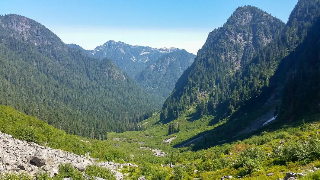
The Hanes Valley Trail makes for a long yet spectacular day hike. Starting from Lynn Headwaters Regional Park you’ll travel through a variety of terrains before finishing at the top of Grouse Mountain.
This hike is best done late in the summer season due the some creek crossings. Early in the summer when the snow melt is at its peak, the creeks are quite large and flow with a lot of force, making crossings quite dangerous (or impossible). There is also snow for much of the year on the climb up to Crown Pass and on the Pass itself. The boulder field leaves much opportunity for injuries. Bears are also relatively common on this trail. In other words, BE PREPARED ON THIS HIKE.
Also, if you are not willing to hike the entire 30 km loop, you will need to plan out the logistics of dropping a car at the Grouse Mountain parking lot, and have money to take the Skyride down (or be prepared to hike down the BCMC trail).
Warning
This hike is among the more difficult of all the day hikes around southwest British Columbia. This guide is not intended for beginner or new hikers. Please make sure you are in good fitness and take all regular safety precautions on this hike.
Hanes Valley Hike Stats (to Grouse Mountain Chalet)
Rating: Difficult
Distance: 17 km
Net Elevation Change*: 1,130 m
Highest Point: 1,320 m
Time Needed: 7+ Hours
Type: Point-to-point
Season: Late summer to early fall
Dogs Allowed: Not on Grouse Mountain
Est. Driving Time from Vancouver: 30 Minutes
Trailhead Coordinates: 49.359619, -123.027950
Hanes Valley Hike Stats (for full loop)
Rating: Very Difficult
Distance: 30 km
Net Elevation Change*: 1,130 m
Highest Point: 1,320 m
Time Needed: 10+ Hours
Type: Loop
Season: Late summer to early fall
Dogs Allowed: Not on Grouse Mountain
Est. Driving Time from Vancouver: 30 Minutes
Trailhead Coordinates: 49.359619, -123.027950
*For a better understanding of the stats and difficulty rating, check out the Hiking Guides page for details. Always carry The Essentials and fill out a trip plan.
Hanes Valley Video
Here is a 2-minute video of our experience on this hike!
Hanes Valley Hike Map and Elevation
Hanes Valley Loop
Profile
Hanes Valley Hiking Route
The trail to Hanes Valley starts at the Lynn Headwaters Regional Park. (You can also do this hike from the top of Grouse down, but navigating down the boulder field is less safe than travelling up). There are numerous trails in the park, including great hikes up to Coliseum Mountain and Lynn Peak. There is a trail map for the park here. Starting from the northern tip of the parking lot, you take the Lynn Loop Trail north. As cross the bridge over Lynn Creek, there is a sign-board with a hiker registration box. Enter your name and trip details here (just in case).
The first part of the hike is easy – just follow the well-defined trail north for about 1.8 km until you come to a junction and a trail sign. You could cut up here to the Headwaters Trail above you, but instead keep heading north, now along the Cedar Mills Trail. Follow Cedar Mills for about 2.3 km until you join up with the Headwaters Trail at the Debris Chute. This open area is recognizable from the North Shore Rescue gear cache. Walk up the loose rock until you find the singletrack trail once again, and carry on left at the junction.
From here the trail will start to become a bit more challenging. Keep going north, following the numerous yellow trail markers. 2.6 km beyond the Debris Chute junction you’ll come to a junction where you can go right to Coliseum Mountain. Just a few minutes beyond this point is another junction, where going right will take you to Norvan Falls. Go to Norvan Falls if you want, its only a 10 minute detour and worth the effort.
From the Norvan Falls junction, going left will take you over a metal bridge and onward to Hanes Valley. From here the trail become a bit harder to follow, but there are still plenty of markers to keep you on track.
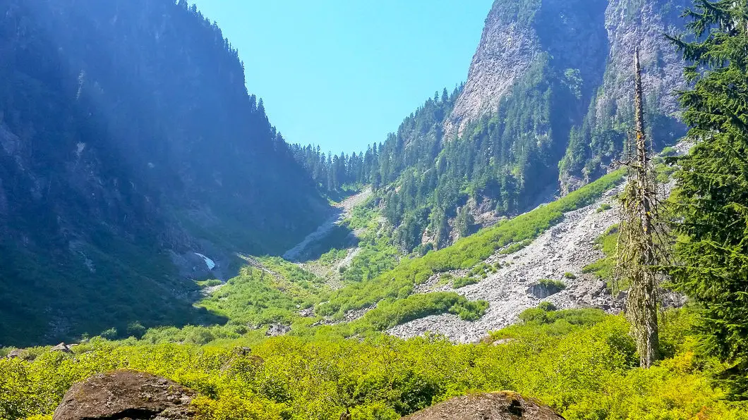
Keep your eye out for a marked junction in the trail. Keeping north will take you to Lynn Lake. Heading west (left) will take you along the Hanes Valley route. From this junction it is just under 4 km to reach the Crown Pass. Make sure you go left at this junction, and you’ll soon come to your first creek crossing. The creek can be impassable during heavy rainfall periods or during heavy snow-melt. There are some logs and large boulders you can use to make yourself across the creek – with much caution.
Once across the creek, pick up the trail again. There are a couple other creek crossings, but you will continue to follow the trail through the forest in the valley floor before coming out into the open. There is another North Shore Rescue gear cache here and an helicopter landing pad. This is a good place to enjoy the scenery and take a break, because the most difficult part of this hike lies ahead – Hanes Valley itself.
Continuing from the Hanes Valley boulder field
The next kilometer is an unrelenting climb up a steep rock slope. There is (hopefully) orange tape and some cairns to guide you up the slope, but you’re basically going to go right up the gut of the valley, to the top of the rocky slope. This part of the hike accounts for about 500 m of elevation gain and can be very dangerous if there is snow/ ice.
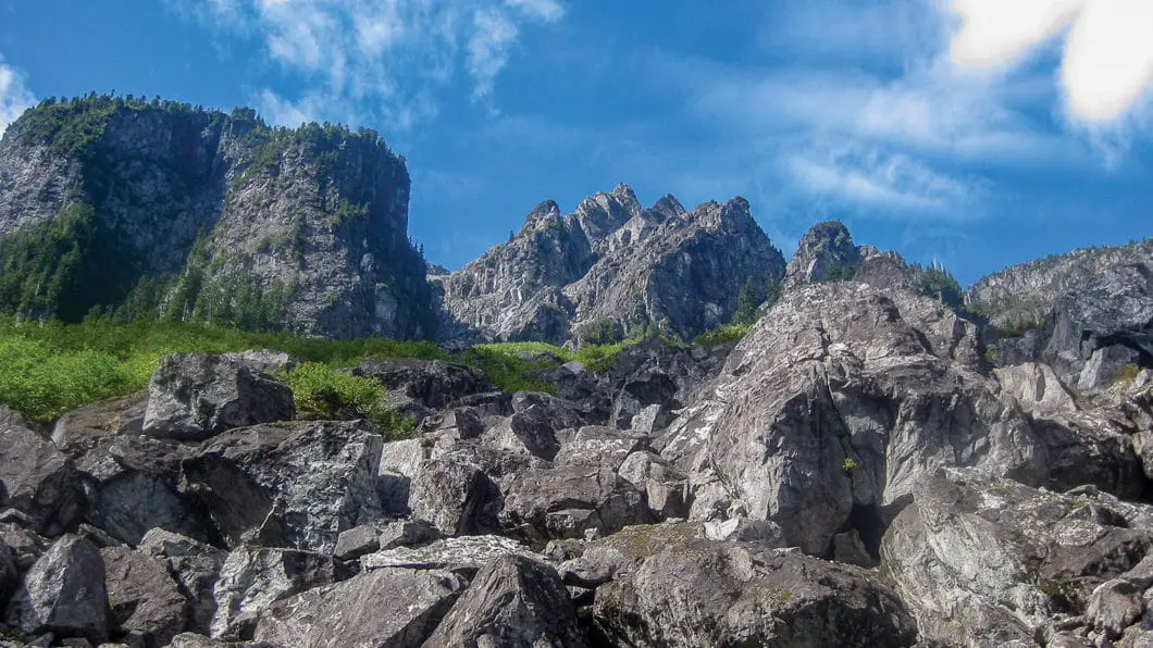
Once you reach the top of the boulder field, you’ll be back into the trees and onto trail. This is Crown Pass and there will be a sign here. Going right will take you up to Crown Mountain. Going left will take you up to Grouse Mountain. Go left and push up some more challenging and steep trail. This section is very technical and there are chain-assisted sections. After 1 km of uphill fighting you will be at the trailhead for Goat Mountain. There’s about 2 km of hiking left, but the most difficult part is over.
You will also pass by junctions for Little Goat Mountain and Dam Mountain, which aren’t very big detours if you wish to go in those directions and back to Grouse Mountain via the Ridge Trail. However, the most direct route is to follow the signs down to the resort via the Alpine Trail.
The Alpine Trail will take you out under the Peak Chair, to the grizzly bear enclosure and finally the Grouse lodge. Here you can grab a snack in the lodge and then catch the gondola down the Grouse Mountain parking lot. Since this isn’t an out-and-back, you’ll either want to have 2 cars, or plan to take transit. Transit should be relatively easy as there is a bus from Grouse to Lonsdale Quay (#236), and one from Lonsdale Quay right up Lynn Valley Road (#228) where your car will be waiting.
If you wish, instead of taking the Skyride down, you can continue along Old Mountain Highway (by following the dirt road under the Olympic Express chair) all the way back down to the Baden-Powell Trail. Once you hit the Baden-Powell junction, going left will take you back to the Lynn Headwaters Regional Park parking lot, completing a full 30km loop.
Old Mountain Highway is not a very exciting hike however, so unless you’re running and wanting to get the extra mileage in, you’re better off just ending your day at Grouse. When descending Old Mountain Highway, there are many mountain bike trails you can take to shortcut the large switchbacks of the road, if you know your way around Mount Fromme.
Download the PDF version for offline use on any device
Directions and Parking
From Highway 1 take the Lynn Valley Road (exit #19 north) in North Vancouver. Follow the road all the way up the Lynn Headwaters Regional Park parking lots. You can also park on the residential street near the End of the Line Cafe and hike in from there.
Google Map directions are here.
Other great hikes in this area and related posts
- Hiking Crown Mountain (difficult)
- Hiking Coliseum Mountain (difficult)
- Hiking Norvan Falls (moderate)
- Hiking Goat Mountain (moderate)
- Talking about the Hanes Valley Trail on CBC
- View all hiking guides here





Linda
I’m doing the Hanes Valley hike on Saturday with 5 friends. Do you know if there will be snow in the pass at this time of year (August 10)? What type of footwear would you recommend? Thanks!
Karl W
Hi Linda,
I did this 2 weeks ago, and up to Crown – no snow at all to worry about! Wear your regular hiking footwear. Have fun!
Linda
Thanks Karl, really appreciate your reply. We’re heading out in an hour – should be a great day!
Karl W
Awesome, let me know how it goes!
Linda
Hi Karl – not sure if my last reply reached you? Anyway, the hike was amazing. The boulder field/scree slope was definitely the toughest part. It took us 8.5 hours to get from Lynn Headwaters to the chalet at Grouse, including stops. There was a patch of snow to play in and that helped cool us off. Didn’t see any wildlife other than swarms of black flies whenever we stopped. Thanks for your input on the shoes – it really helped. Cheers!
Karl W
Awesome! Glad you enjoyed it. Yeah, two of those blackflies decided to take chunks out of my leg when I did it, and I wasn’t stopped, it was while I was running! But it’s a great hike and no easy accomplishment, glad you were able to tackle it!