Howe Sound Crest Trail – Table of Contents
- Hike Introduction
- Hike Statistics
- Map and Elevation
- Hiking Route Description
- Camping on the HSCT
- Directions and Parking
- Free PDF Download
Howe Sound Crest Trail Hike Intro
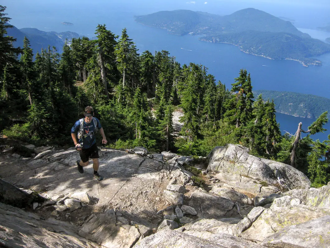
The Howe Sound Crest Trail (HSCT) is a gorgeous 29 km trail stretching from Cypress Bowl to Porteau Cove. The trail takes you over multiple summits, offering spectacular views of Howe Sound, The Lions, and the beautifully turquoise Deeks Lakes, to name a few. The trail is no walk-in-the-park and is typically tackled as an overnight trip, which is the safest way. However, it can be completed in one day by an experienced and fit person. I completed the Howe Sound Crest Trail with a friend as a trail run in about 9 hours.
If you wanted to hike, and start the day very early, you can surely traverse the whole trail in one day, just be prepared to be finishing your hike in the dark, and tired. The scenery is so spectacular that you’re better off planning to camp overnight, and taking the time to enjoy the trail without risk of getting stuck in the dark overnight if your day-hike doesn’t go to plan. There are several popular spots to camp, detailed below in the post (open fires are not permitted).
Warning
This hike is among the more difficult of all the day hikes around southwest British Columbia. This guide is not intended for beginner or new hikers. Please make sure you are in good fitness and take all regular safety precautions on this hike.
Howe Sound Crest Trail Hike Stats
Rating: Very Difficult
Distance: 29 km
Net Elevation Change*: 610 m
Cumulative Elevation Gain: Approx 1,830m gain / 2,600m descent (according to my personal GPS, not including ascent of west Lion). Reverse those numbers if you start at Porteau Cove.
Highest Point: 1,542 m (Unnecessary Ridge)
Time Needed: 1-2 Days
Type: Point to Point
Season: Late Summer
Dogs Allowed: Yes (on leash)
Est. Driving Time from Vancouver: 30 Minutes
Trailhead Coordinates: 49.395901, -123.203933
*For a better understanding of the stats and difficulty rating, check out the Hiking Guides page for details. Always carry The Essentials and fill out a trip plan.
HSCT Hike Map and Elevation
HSCT
Profile
A word of caution
Given the altitude and terrain of much of the Howe Sound Crest Trail, you’ll want to be prepared for snow, and make doubly sure you take all the regular hiking safety precautions. This is a summer-use only trail, as there are several areas along the trail that pose a high level of avalanche danger. Also, late in the summer there are very few opportunities for fresh water on large stretches of the trail.
This is a long, difficult hike and you should be prepared for it.
You can tackle the trail north to south, but south to north is more common as it provides a net-downhill in elevation from Cypress Bowl to Porteau Cove. You’ll either need to drop a second car in Porteau Cove or have a friend pick you up on your exit from the trail. Keep in mind, while the elevation gain on this hike from the trailhead to the highest point is only 610 m, you’ll climb closer to 1,800 m in cumulative elevation gain over the length of the entire trail if you hike south to north. I’ll describe the hike as starting from Cypress Mountain.
HSCT Hiking Route
To begin the hike, go to the Cypress Mountain parking lot (exit #8 off Hwy 1). Park at the farthest parking lot closest to the ski lodge. There is a BC Parks map at the trailhead and you there are plenty of sign posts marking ‘Howe Sound Crest Trail’ to get you started. The beginning stretch of the trail is well marked and maintained and should be easy to stay on track.
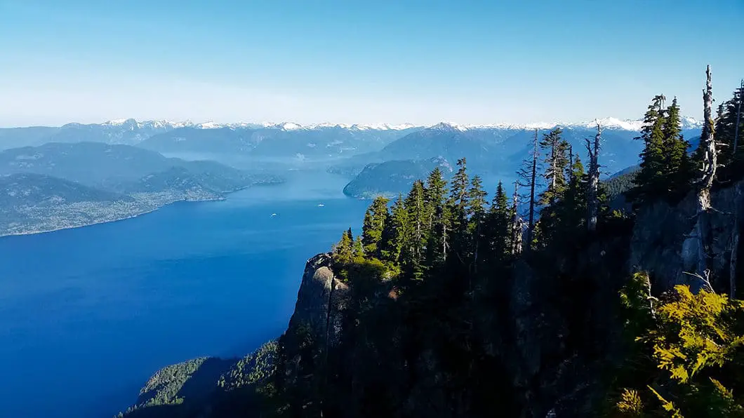
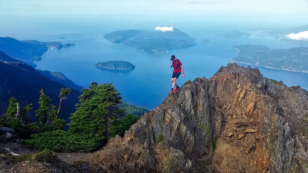
The trek up to St. Mark’s Summit has recently undergone some major maintenance and is well-marked, wide, and easy traveling, aside from the steady gain in elevation. The hike to St. Mark’s Summit is about 5.5 km. Once at the summit, you will need to take a quick detour off the HSCT to the trails on your left to enjoy the incredible view of Howe Sound. From here, you can see Mount Gardner on Bowen Island.
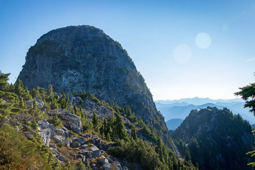
After leaving St. Mark’s Summit and heading back onto the HSCT, you continue north with Mt. Unnecessary South and North peaks standing between you and The Lions. If you’ve ever wondered how Mt. Unnecessary received its name, you’ll now find out. The trail is not as well developed from here on, but there are still lots of trail markers. There is a steep climb up to Mt. Unnecessary Ridge.
Provided you don’t scramble up the west Lion, this is actually the highest elevation for your trip at 1,542 m. Mt. Unnecessary offers spectacular scenery in all directions (Howe Sound to the west, North Vancouver to the East, and The Lions due north).
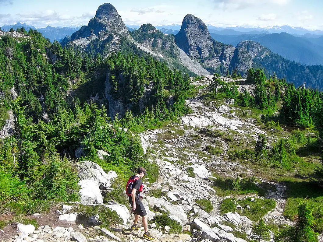
From here, you carry on to the infamous Lions. You can scramble up the west Lion (with extreme caution) if you’d like, but this adds more distance, elevation, and time than what is listed in the Howe Sound Crest Trail hike specs of this guide. To continue on the Howe Sound Crest Trail, you’ll find the trail veers down to your right, and flanks the west Lion on its east face.
Beware of rocks falling from those scaling the Lion above you. If you have a heavy pack, this part will also be difficult as you scale across the west Lion to the col between The Lions. The col between The Lions is a nice spot to take a break, enjoy the view, and get a lay of the land ahead of you.
Beyond The Lions
Next stop, James peak. The trail drops from the col and carries on around Thomas peak as you scramble over some boulders, and then climbs to Enchantment Pass. Once you reach the top of James peak, you’ll have great views in all directions. There is a fairly steep drop off the other side of James peak, and you will carry on the trail to David Peak. This section of the trail is within the trees and parts of the trail feel a bit overgrown.
Once you have made your way over David Peak the trail will open up again and you will soon be in Magnesia Meadows. All told, from the West Lion to Magnesia Meadows is about 4 km of technical trail. Beyond David Peak there is a trail junction that connects to Mount Harvey to the west – make sure you stay due-north on the HSCT towards Brunswick Mountain.
Download the PDF version of this guide for offline use on any device
At Magnesia Meadow there is an emergency shelter. Carrying on past the shelter, you will climb a bit and enter the forest before coming to the junction for Brunswick Mountain. If you take the trail up (to your right) you will head up Brunswick, or down (to your left) and you will head down into Lions Bay. You can detour up to Brunswick Mountain if you have the time and energy.
Instead, cross the trail and follow the Howe Sound Crest Trail northwest along Hat Pass. The trail will then descend to Brunswick Lake Hut, with some amazing scenery on this stretch of the trail.
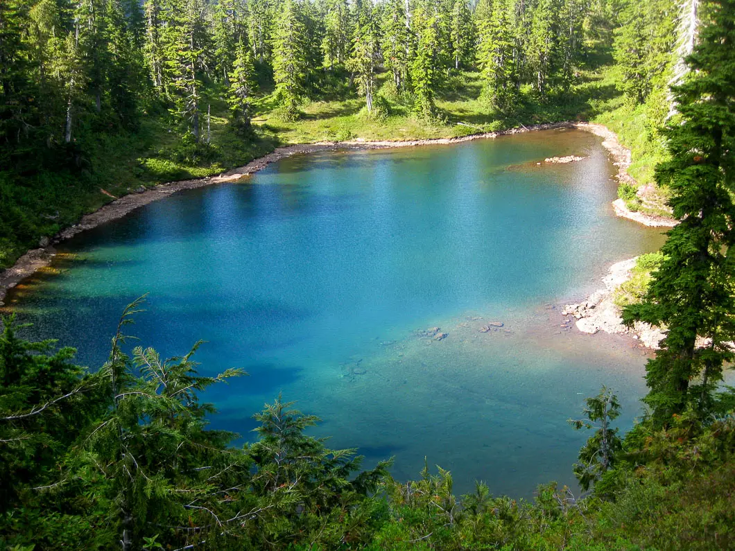
There is a creek connecting Brunswick Lake to Deeks lake and the trail will parallel it. You will come to a waterfall, and views of Middle Lake and Deeks Lake.
Once you have reached Deeks Lake, you’re on the home stretch. Its now a steady downhill slog to the Porteau Cove parking lot. Once you come out from the trail there is a logging road, which carries you all the way to the parking lot. If you have a capable vehicle (AWD) you can actually drive your car up here from the parking lot (or have your friend pick you up at this point) by skirting the gate, which may be frowned-upon – I’m not sure. Otherwise, follow the logging road for the final 2 km or so to the parking lot.
Camping on the HSCT
For camping, your best source of information will come from BC Park’s page for Cypress Provincial Park, excerpted below:
Walk-In/Wilderness Camping Wilderness, backcountry or walk-in camping is allowed at higher elevations beyond the Alpine and Nordic ski areas and along the Howe Sound Crest Trail, but no facilities are provided. There are 4 preferred sites along the Howe Sound Crest trail.
- Plateau above Enchantment Lake (11 km from Cypress Mountain Resort);
- Magnesia Meadows (14.5 km from Cypress Mountain Resort );
- Brunswick Lake (19 km from Cypress Mountain Resort);
- Deeks Lake (22 km from Cypress Mountain Resort).
Tent pads or sites are not provided. Campers are encouraged to camp in cleared areas as to limit environmental impacts. The backcountry of Cypress Provincial Park can be rugged, and weather is often severe. Campers should be experienced in the backcountry and prepared for all weather conditions. Campfires are NOT permitted. Backcountry winter camping (1 km beyond Alpine and Nordic ski areas) is allowed. No facilities are provided. Backcountry travelers are encouraged to use extreme caution in avalanche terrain.
Running the Howe Sound Crest Trail
For trail runners, it doesn’t get any better than this. Doing a car-drop and going light means you can traverse the whole trail in a day. Below is a great 3-minute video from Jeff Pelletier of his run of the HSCT.
Regarding trail running, I have received the following note from a reader, so please do your part to ensure there is no litter on the trail. Please pick up any inadvertently dropped litter you find: “The only litter I found on this trail was many tear-off strips of used gel packs, at regular intervals, suggesting that perhaps trail runners were doing the littering.”
Directions and Parking
For this Howe Sound Crest Trail hike, typically one car is dropped in Porteau Cove. The parking lot is off Porteau Road just about 15 minutes north of Lions Bay on the Sea to Sky highway.
Here is the Google Map for the Porteau Cove Parking lot.
Here is the Google Map for Cypress Bowl.
Help Us Create New Hiking Guides!
Advertising revenue is falling quickly across the internet, and independently-run sites like Outdoor Vancouver are hit hardest by it. We are committed to keeping Outdoor Vancouver free and independent, but we need to find other ways to continue operating this site.
If you like our hiking guides and would like to help, please consider making a contribution with the PayPal or Patreon links below – any amount helps! There is also a list of other ways you can support Outdoor Vancouver here!
Becoming a Patron through Patreon unlocks membership benefits and rewards. Learn More.
A one-time donation through PayPal helps with monthly website hosting costs.
Other great hikes in this area
- Hiking St. Mark’s Summit (moderate)
- Hiking Brunswick Mountain (difficult)
- Mount Strachan (moderate)
- View all hiking guides here





ImoForPc
This trail looks absolutely stunning! I’ve been looking for a new hiking adventure and the Howe Sound Crest Trail sounds like the perfect challenge. I love that it offers breathtaking views of the surrounding mountains and the ocean. Can’t wait to check it out!
morpheus
i will be doing the HSCT this juy 17-18.. I will have a short visit in BC this week and want to make the most of it.
if you will be doing this hike on the same date then, see you on the trails.
Stéphane Perron
July 19, 20. We completed the HSCT over two days from Cypress to Porteau, camping at Magnesia. Sunny, 30C weather. 30 lbs packs. We are 60 year old hikers, one with an artificial hip. Both with a lifetime time of hiking experience. It took us 13 hours with lots of breaks and a slow pace. I was sweating hard. We found the trail to be quite engaging but by the time we reached David Peak we were done and really looking forward to get to our campsite. I suspect there is little water in August but in mid-July there was enough snow patches remaining to refill our water bottles. Lat snow patch and therefore last water was below the west Lion along the trail. We used three litres each. The bugs were present but not so bad; we’ve seen worse. It help to keep moving. The trail beyond Magnesia is of a totally different character and quite enjoyable. The scenery around Brunswick Lake is quite dreamy and perfect for a swim. A lot fewer bugs than a Magnesia which was bad. We used our GPS a few times when we missed certain turns along the way. Adding a night at Unnecessary (little water in mid-July) would be one way to break up the first long day.
David
Great article. I did this hike over two days, just finished. I want to point out one correction or change to the route. The article says that you go over James Peak and around David Peak. However, the trail now takes you right over the top of David Peak, which is a scrambly, steep scree slope on the way up and a very steep descent. It’s mentally challenging as we thought we were nearing the end of a long day and still had to go over another mountain.
Jonathan Tse
Hi All,
Does anyone know if you can park overnight at the Porteau Cove parking for doing the HSCT over two days?
Elle Bee
Also… plan for extra time. Because this hike is so challenging it took us longer then expected. We were rushing against the clock. Make sure you have more then enough time because you will need it!
Elle Bee
NOT DOG FRIENDLY!! This site labelled this hike as “dogs allowed” but this is not a dog friendly hike. I highly HIGHLY suggest you leave your fur baby at home. After reading about the hike on this site I mistakenly brought my dog. He is a 6 year old hound, 60-pounds, super fit and energetic. I had to lift him several times to get over the boulders and steep ridges. It was super terrifying for me and him. Once we reached James Peak we could not make it past the ridge with the cable rope. We had to be evacuated by the search and rescue team. It was super scary and disappointing. I am beyond grateful for the Lions Bay Search and Rescue team. They are well-trained, super informed and such a kind group of volunteers. They are life savers. Don’t do what I did. Huge learning lesson for me, and I hope you can learn from my experience as well. Leave your dog at home. Other then that it is such a beautiful hike, panoramic views! But not for the faint hearted. This is a challenging hike! Be prepared.
Will
Advice to people considering doing this trail (tl;dr):
– Don’t take the service road down to Lions Bay that starts just before Magnesia Meadows (if you need to get down to Lions Bay from Magnesia Meadows, take Brunswick Mt trail instead)
– The Porteau Cove exit may or may not be closed
– Be prepared for an extremely difficult and long hike
– There is currently very little snow on some parts the trail, but its no problem as long as you go around the large patch in the scree field about 500 meters past James Peak. There is also one small section that must be crossed between the Lions and James peak that is a little sketchy
We did this trail in the wet last weekend, and I have to say that the rain wasn’t all bad as most of the trail is on rock which doesn’t get as slippery as mud and roots (which admittedly do make up some portions of the trail). Also, the cool, wet weather meant that we didn’t get as hot, and didn’t need to drink as much water.
I am no stranger to long day-hikes and navigating extremely steep and difficult terrain, however this was my first ever overnight hiking trip. Yes, it was difficult, especially with the heavy bags, but we managed, and I definitely don’t regret it. If you plan on doing this trail for the first time just be prepared to be doing some rock-climbing with your over-night bag on.
We opted to start on Cypress and make our way to the Magnesia meadows shelter for the night. That took us 10 hours in the wet. Personally, I think I could probably do it a fair bit faster if I were to do it again in the dry.
The second day we opted to head down to Lions Bay after reports that the Porteau Cove exit is closed (I’m still not 100% sure if it is technically closed as another group said they went up it no problem). However, if you also decide to head down to Lions Bay, DO NOT attempt to exit via the service road before Magnesia Meadows (there’s a sign at the fork that says Lions Bay) as it is completely overgrown. We bushwhacked for about 3km in neck-high brambles until the junction with the Lions trail. Had it not been for some decent trail-markers there is no chance we would have been able to stay on-trail. If you plan on returning to Lions Bay after Magnesia Meadows, make sure you take Brunswick Mountain Trail instead.
Overall, I would definitely do it all again in the dry to see some of the views we missed due to clouds and fog.
Sophie
Hi there! A friend and I are thinking of hiking to Magnesia for the night then either returning to the Cypress lot or following the Brunswick Trail (undecided) we were wondering what the water source situation is… I have read some older reviews and people said the main sources were sn0w pack and want to make sure there even is any snow or if there is another source. Also did you have cell service the whole way?
Thanks!
Sophie
Will
Hey Sophie,
If its your first time on the trail I’d probably recommend taking Brunswick down, as returning to Cypress is a long way. I know my legs and shoulders were not ready to do that hike again on the second day. As for water, you can use snow-melt as there should be a fair bit left along the trail. I forget where exactly we first saw snow, but I remember seeing quite a bit near the lions. Other than snow, there is the lake just before the meadows which definitely requires water purification tablets. As for cell service, its intermittent. The shelter did have passable signal for me however.
Hope you guys have fun!
Grant
Completed this trail last weekend, Oct 20th. 9:30 am start, with a 25 lb backpack. Steady walking pace with breaks, I was able to make it to Magnesia Meadows by 5:30pm. There was no on trail water from Cypress UNTIL Magnesia Meadows. I was able to hike this stretch with 2 litres. Very challenging terrain on that section from hour 3 until hour 8 . Magnesia is an ideal location to camp, with fantastic views at sunset. Limited availability to hang hammocks though… as I discovered. Next day I was able to get the Porteau in 5 and a half hours at the same pace, Easier terrain with long steep downhills. Dogs are not an option on this trail. Expect challenges, many challenges. Very worth the effort. Good luck. ;)
Les
I’m glad we did this on a sunny fall day (drier, no bugs). Absolutely stunning and completed in under nine hours with the added Brunswick peak. Pretty quick pace but beautiful nonetheless.
Vince
Three of us did the hike up to the Lions from Cypress then hiked down to Lions bay via Lions Binkert Trail. We spent the night at the west lion which was great! Spectacular views of the city and was relatively warm. We woke up to rain which quickly turned to snow which made navigating the trail at the top pretty challenging as there are few trail markers in this area.
I lost a phone at a view point of the east lion or on the ridge trail between the west lion and the watershed sign. Due to the snow in the morning there was no sign of it. It’s white which doesn’t help. If you happen to find this white google pixel can you please email me? I would be stoked to have it back again.
[email protected].
There are so many great photos from the spectacular views that we had.
Please do not plug the phone in if you find It. I’m guessing that due to the snow it is soaked and I don’t want to fry it.
Vivenne
On the KMZ file the earliest campsite (if coming from Cypress) is Magnesia Meadows, but the Cypress Provincial Park excerpt above says there’s also the Plateau above Enchantment lake just 3km before that. I don’t see this marked on the KMZ map data but can anyone indicate whether this is easy to find? We might not reach Magnesia Meadows before dark. Thanks!
spencer
100% agree with Anne that this hike is easily doable in one day, it took us 8 hours going from Cypress parking lot to Lions Bay (including a 1-hour break at the top), Going down to Lions Bay can be hard on the knees at the end, but otherwise the hike wasn’t too difficult for an above average hiker.
Maretta
I was wondering if there was water by Magnesia Meadows, as mentioned in other reviews. I am thinking of doing this hike this weekend. Your input old be appreciated. Thanks.
Mia
Heh!
The HSCT is really Cypress Mountain all the way to Porteau Cove, not just down from the Lions to Lion’s Bay — just saying this in case others think the whole thing is easily doable in one day!
Will
Did the trail in a long day, August 18th. We went south to north and were about 10 hours car-to-car. No snow or water save for a couple really gross tarns until a trickle a few hundred meters past Magnesia meadows, so make sure you plan ahead this summer and bring ample water, especially if you’re camping. Smoky out there!
Ollie Linsley
Hi Karl me and a pal are thinking of heading up Brunswick mountain next weel but have been advised there is still snow at the top so we will be cutting at the HSCT intersection and heading past the three lakes and onto porteau cove, do you have any idea how long that stretch from the intersection to Porteau is and how difficult we will find it after making our way up Brunswick Mount?
Karl W
Hi Ollie,
I haven’t been up there this year but I suspect you’ll hit snow even before the junction in spots along the trail. If you can wait a month before going, I would. It’s difficult to predict a time as it will depend on fitness and just what the conditions really are. I would suggest you start early, and give yourself a full day to accomplish it.
Sorry I can’t be more specific – it’s also been a few years since I’ve done the HSCT and can’t recall how long that particular stretch took. We were trail running, and it was in the late summer so the trail was bone dry.
Good luck – be safe!
Karl W
Mathieu,
Thanks for the update! Glad you were able to complete the hike and the weather cleared up for you at the end. Thanks for providing the details on the time needed to tackle from Cypress.
And thanks for grabbing a copy of the book!
Karl
Travis
A friend and I have just completed this hike over 2 days, and I just want to highlight something to all of the hikers who are reading this and may not be uber-serious outdoorsman. This hike is NOT EASY. It can be VERY HARD with 30+ pounds on your back. Following the South/North trail direction mentioned above -> the first day from Cypress Bowl to Magnesia meadows took us 11.5hrs. And we are above average fitness. The last 5kms before magnesia meadows, took 5hrs.!!! ( Which is hard work after hiking all day from Cypress Bowl AND over the lions)
This hike IS gorgeous, the scenery is unbelievable, it truly is Just be prepared for one of the hardest 1st day hikes that you’ve ever done.
I highly recommend it through :-) I think 3 days might be a good time frame if you are doing it for the first time. Then wind it back as you get better.
Kudos to the Author for a great article….
Karl W
Thanks Travis!
Yes, it is no joke. I think I will update the rating from ‘difficult’ to ‘very difficult’.
Either way, glad you enjoyed the hike and the amazing scenery! Thanks for taking the time to comment back on the post, and for sharing your experience.
Karl
Mathieu
Hey Karl,
I wonder if you ever did a round-trip hike from Cypress Bowl and back, and if so how long is the trail and if it’s a good 1-day hike?
It seems that it would be a better way up to the Lions compared to the trail from Lions Bay.
What’s your experience?
Thanks so much, great blog
Mathieu
Karl W
HI Mathieu,
I haven’t done the Lions as a out-and-back from Cypress. I think it would be a more scenic route than Lions Bay. However, I think it takes a bit longer as the total distance would be longer. I know its doable as a day-trip, but it would be a long, difficult hike.
Starting at Lions Bay is the more popular route, I think because its shorter, but if wanted better views (ie, St Marks, Unnecessary Mountain), then Cypress is the way to go.
You could follow the instructions to this guide, and just stop at the Lions. Also, if you choose to summit the west Lion, be very careful, as it is a very exposed scramble and a bad slip would not end well.
Let me know how it goes if you do it!
Karl
Mathieu
Karl,
I’ve just completed this hike last Saturday, from Cypress Bowl to the Lions and back.
As described, each way is 10.5km, so in the hand it’s a scenic one-day hike with rugged terrain and lots of elevation (positive and negative) gain.
Compared to more classical routes where the way back goes faster than the way up, it took us exactly the same time (4h30m each way), because:
– there is still uphill to do on the way back (you really understand Unnecessary Mountain’s name);
– some sections are really tricky on the way back, with some ropes and big rocks, terrain could be muddy / slippery if it’s rained.
So the main advice would be to plan extra time to be able to get back in time.
Weather-wise, we haven’t been lucky as it was really cloudy / foggy until mid-afternoon and we couldn’t even see the West Lion despite being at the lookout which is a few hundred metres from the summit…
But when it cleared out, the view on the Howe Sound was magnificient.
Thanks so much for your blog and for your e-Book, which I recommend to anyone who likes clear directions during their hikes.
Mathieu
Jozef Povazan
Great hike. Any bride who wants to have a wedding here? We are in :) We had brides climbing panorama ridge at Black tusk, Whistler Mt., and more crazy places… This hike under Lions is very nice. JP
[WORDPRESS HASHCASH] The poster sent us ‘0 which is not a hashcash value.
Kelvin
Hi there, how were the winter conditions for this hike? We are thinking of doing the hike in a few days (Nov.11-13) and are concerned by the slippery conditions caused by snow. We were only planning to use hiking boots but could bring snowshoes if necessary. Any advice would be appreciated!
Karl W
I’ve never done this one under snow. Given the technicality of the trail at several sections, snowshoes may hinder you more than they help. The BC Parks website states several parts pose an avalanche risk and while there probably isn’t a lot of snow at this point I wouldn’t even attempt it without considerable winter backcountry experience under your belt. Save it for next summer on a blue-bird day when you can enjoy the insane views.
Karl W
There are a few spots but water is very limited. It’s been a while since I did the entire HSCT, so I can’t recall exactly where there was water. But if you climb a short way down on the Lions-Binkert trail on the west side of the west lion – there was a good amount of water from the remaining snow melt when I was there last week. I believe after Magnesia Meadows you will find some more. But I would err on the side of bringing plenty of water, despite the extra weight.
jesse
Thanks for the review, how much snow did you encounter?
KB
Hi, how did you deal with the closure of part of the trail through Porteau cove?
Matt Arthur
reboot this question
June
+1. did anyone go down to porteau cove parking lot recently?
iliketocycle
I hike most of the trail last weekend. I exited to Lions Bay, but did meet numerous people who had come from Porteau Cove and more planning to exit that way. We got a ride back from Lions Bay from some people that had come out at Porteau Cove. They just ignored the closure signs, but it was a Sunday so maybe the mining activity during the week would make a difference.
Robert
Excellent review! Especially posting the times between points. I’m using the times to calculate a hike from Cypress and back to Cypress.