Joffre Lakes – Table of Contents
- Hike Introduction
- Hike Statistics
- Joffre Lakes Video
- Map and Elevation
- Hiking Route Description
- Directions and Parking
- Free PDF Download
Joffre Lakes Hike Intro
Joffre Lakes is a popular hike located just north of Pemberton in Joffre Lakes Provincial Park. Easy trailhead access and gorgeous views make this a busy and well-traveled trail during the summer. It is also a popular destination for ice climbers during the winter months for the same reasons.
The Joffre Lake hike offers a little bit of everything you could want in a day hike. At 10 km, the hike to Joffre Lakes not too long, but with a steady uphill climb and several technical sections, it still offers a challenge. There are three turquoise, glacier-fed lakes, each more spectacular than the last.
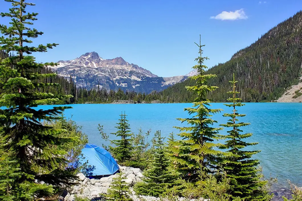
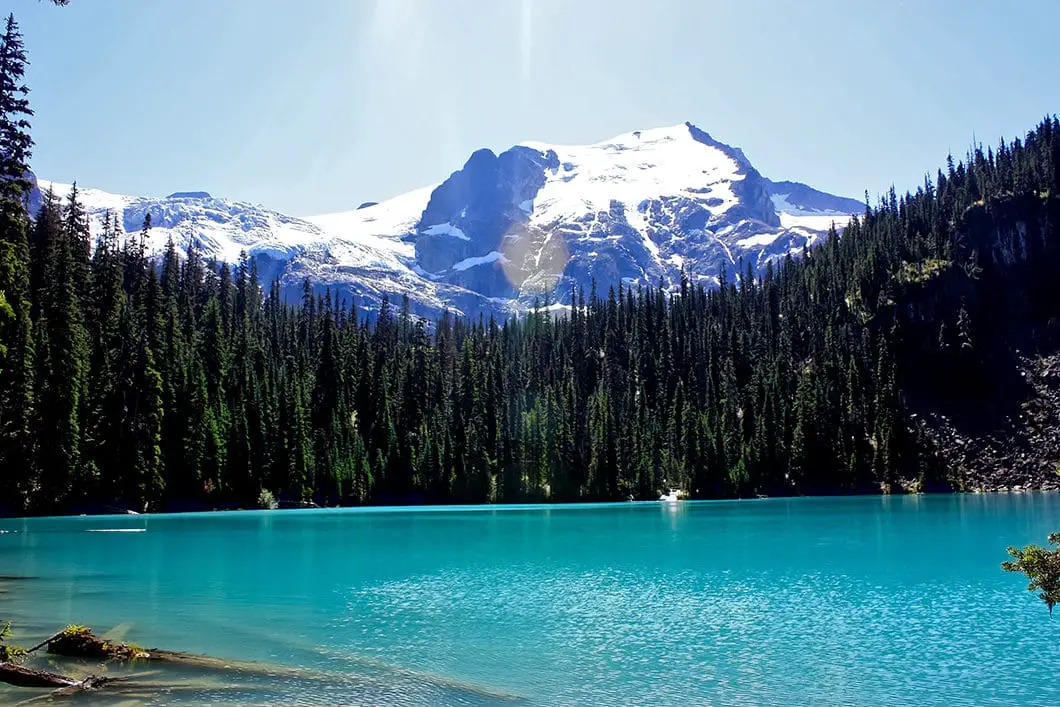
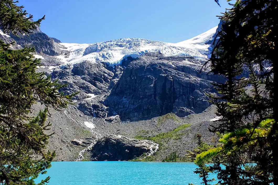
The lakes are aptly named Lower, Middle and Upper Joffre Lakes. Along the way, you are also rewarded with creek crossings, a waterfall, and several viewpoints of the surrounding mountain range. Finally, there’s the scenery at the top, an up close view of the Matier Glacier and a rugged campsite for those wanting to spend the night.
Since 2013, a lot of trail maintenance has been done on the Joffre Lakes Trail – to mixed reviews. From the trailhead to Middle Joffre Lake, the trail is a groomed, dirt path, including the section which used to require scrambling over the moraine field. Steps have been placed in sections, and the trail takes a slightly different route than before in parts. The improvements have made it possible to reach Upper Joffre Lake faster than before, and the route is slightly shorter (closer to 10 km than the often advertised 11 km).
Joffre Lakes Hike Stats
Rating: Moderate
Distance: 10 km
Net Elevation Change*: 400 m
Highest Point: 1,600 m
Time Needed: 4 – 5 hours
Type: Out-and-back
Season: June to September
Dogs Allowed: No
Est. Driving Time from Vancouver: 3 hours
Trailhead Coordinates: 50.369517, -122.498688
*For a better understanding of the stats and difficulty rating, check out the Hiking Guides page for details. Always carry The Essentials and fill out a trip plan.
Joffre Lakes Video
Here is a 2.5-minute video of our experience on this hike!
Joffre Lakes Hike Map and Elevation
Joffre Lakes
Profile
Joffre Lakes Hiking Route
From the trailhead, easily located from the parking lot, the Joffre Lakes hike is a 5 km upward climb through old growth forest of hemlock and spruce, over a boulder field, past the Lower and Middle Lakes and over Joffre Creek to the Upper Lake. Starting your hike, Lower Joffre Lake is a flat 5-minute walk and a quick diversion off the main trail. Lower Joffre Lake sits at an elevation of 1,240 m. The view from Lower Lake will give you a good vantage point of your end goal; the spectacular Matier Glacier that looms high above Upper Joffre Lake.
Quickly doubling back from the Lower Lake viewpoint will take you onto the main trail that leads to the Middle and Upper Joffre Lakes. You’ll initially be walking on a gravel trail, that will turn into a dirt path, which will take you over your first crossing of Joffre Creek just below the lower lake.
After the initial 25 minutes of climbing, or 1.5 km in, you will come to a boulder field. Following the path over the boulders, you will get some views of the coast mountain scenery and hear the roaring sound of Joffre Creek violently rushing just east of you.
Side note: The boulder field is technically called a ‘moraine’; “a mass of rocks and sediment carried down and deposited by a glacier”.

Beyond the moraine, the trail climbs sharply uphill for about the next kilometer until you reach Middle Joffre Lake. Follow the trail up, arriving at Middle Joffre Lake at an elevation of 1,535 m. It is about 3 km to reach the Middle Lake. By this point, you have already covered most of the elevation gain and the final push to Upper Joffre Lake is fairly short. Regardless, the view at Middle Joffre Lake is beautiful and it is worth stopping here for a rest. There is also a toilet here.
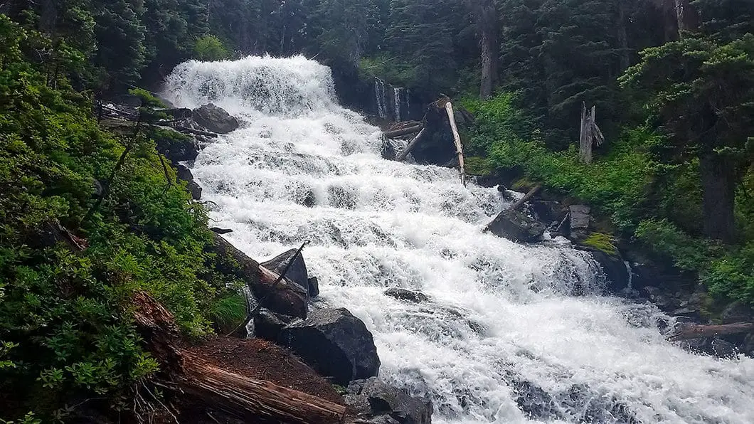
From the viewpoint at the Middle Lake, following the trail, you will come to a beautiful waterfall called Holloway Falls.
From Holloway Falls, you will take a bridge over Joffre Creek. This final stretch of the hike is more technical (rooty and rocky) terrain, but relatively short and you will soon emerge from the trees alongside Upper Joffre Lake, at an elevation of 1,600 m. The trail carries around to the south tip of the lake for a close up view of Matier Glacier. It may be tempting to scramble up to the glacier, but this is not wise as large chunks of ice can sheer off at any moment, tumbling down to the lake.
Download the PDF version of this guide for offline use

From here, there are also routes to Mount Matier and Mount Tszil – both of which require mountaineering experience to climb. At the tip of the lake, you can find a spot to rest, eat and soak up the view of the enormous glacier and the surrounding mountains. Mount Cayoosh looks spectacular off in the distance to the northwest.
There is a toilet at the Upper Lake, and camping is also permitted around the lake. Many people hike in with tents and sleeping bags to enjoy the scenery for a few days. As of 2019, a backcountry camping fee is in effect from June 1 to Sept 30, each year. You can get a backcountry camping permit here. Winter camping is allowed, but is discouraged due to avalanche risk.
“There are approximately 26 wilderness campsites, one urine diversion toilet, and a bear-proof food storage unit. The small gravel campsites are located on the far (south) end of the lake and accommodate small backcountry tents. The campground fills quickly on weekends so it is best to get there in the morning and make alternate plans in case it is full.” [source]
After you have had lunch and snapped your photos of the glacier, you simply need to double-back on the trail back to the trailhead, allowing gravity to do most of the hard work this time.

Directions and Parking
Take the Sea to Sky highway north past Whistler to Pemberton. At the Pemberton Junction (Petro Canada gas station) follow the signs that take you bearing right, towards Mount Currie. After about 7 km, you will turn right on Duffey Lake Road. Once on Duffey Lake Road, you will switchback up the paved road for about 21 km before seeing the signs for the Joffre Lakes Provincial Park parking lot. The trail starts right from parking lot.
Google Map directions are here.
Other great hikes in this area
- Brandywine Falls (easy)
- Nairn Falls (easy)
- Garibaldi Lake (moderate)
- View all hiking guides here


Sue
The walk was a good work out, but well worth it, the lakes & views of the glacier were beautiful. Cloud obscured the view coming down, but not a problem. Would advise wearing good walking shoes or boots as the trail is muddy & slippy in sections. Take water & snacks. Poles if unsure of your footing or have knee problems. I saw some going up in white trainers & fashion clothing, totally unsuitable for the terrain.
When we got to the middle lake it was beautiful, but slightly spoiled by the masses of people taking selfies, feeding the birds & standing in the lake to have photos taken. A shame as it’s a lovely spot. The animals don’t need to be fed either.
Didn’t have time to do the whole walk to the top walk, so can’t comment on that. 2 hours very well spent.
Kate
Hiked Joffre Lakes on 5/22 and it was a stunning hike! Doing it midweek was a good call as it wasn’t overcrowded. The first lake was completely unfrozen, the second mostly unfrozen and the third still mostly frozen over but I could tell it was starting to melt a bit. There’s still a bit of snow/slush at the bottom of the hike and mud on some parts but we brought microspikes and they weren’t needed. A decent pair of hiking shoes will do just fine at this point and we saw plenty of people in nikes/regular sneakers. Highly recommend this hike!
Dana Sherri
Hi there,
I was wondering if you may know what the current conditions are like at the first lake in Joffre?
thank you,
Dana
Karl W
Looks like there is still plenty of snow and will be for some time yet https://www.livetrails.com/trails/Joffre-Lakes-10.html
Start Up Survival
I was just there 2 weeks ago. Amazing trip. Great views of lakes, mountains, glaciers and waterfalls. Kind of tough to find a campsite, and long drive. But over all it was worth it.
Karl W
Glad to hear you had a great trip! It’s been a few years since I’ve been, I should try to do it again next year.
And thanks for the link to your blog and trip report!
Matt
Hi Pat. It’s been hard to find some recent reviews so thanks for posting. Just wondering if yu could see the water yet or if it was frozen over.
Lisa
Would like to know if the lake I should frozen over still or if it has thawed please??? Anyone???