St. Mark’s Summit – Table of Contents
- Hike Introduction
- Hike Statistics
- St. Mark’s Video
- Map and Elevation
- Hiking Route Description
- Directions and Parking
- Free PDF Download
St. Mark’s Summit Hike Intro
St. Mark’s Summit is a peak along the Howe Sound Crest Trail that offers spectacular views of Howe Sound. Hiking the entire Howe Sound Crest Trail (which runs all the way to Porteau Cove) is more than a simple day hike, but heading to Saint Mark’s Summit is a worthy destination of its own and can be done in about 4 to 5 hours. From the peak you can see the islands of Howe Sound, the Tantalus Range and even Vancouver Island.
Overall, the hike isn’t too strenuous as there is only 460 m of elevation gain (one of the bonuses of starting from a ski resort parking lot) making St. Mark’s Summit one of the more popular hikes on the North Shore.
St. Mark’s Summit Hike Stats
Rating: Difficult**
Distance: 11 km
Net Elevation Change*: 460 m
Highest Point: 1,370 m
Time Needed: 4 – 5 hours
Type: Out-and-back
Season: July to October
Dog Friendly: Yes, on leash
Est. Driving Time from Vancouver: 30 minutes
Trailhead Coordinates: 49.395863, -123.203891
**Rated as difficult as many people have gotten lost on this trail, requiring rescue.
*For a better understanding of the stats and difficulty rating, check out the Hiking Guides page for details. Always carry The Essentials and fill out a trip plan.
St. Mark’s Summit Video
Here is a 3-minute video of our experience on this hike!
St. Mark’s Summit Hike Map and Elevation
St. Mark's Summit
Profile
St. Mark’s Summit Hiking Route
To begin the hike, go to the Cypress Mountain parking lot and walk towards the main ski lodge (which sits in front of the large Olympic rings. In front of the lodge, you will see two separate trail markers. The Howe Sound Crest Trail starts at the northern trail, closest to the Lion’s Express chairlift.
This marker (along with others on the route) points you in the direction of the Howe Sound Crest Trail and The Lions, without specifically mentioning St. Mark’s Summit. This is the direction you want to follow at any junctions you come across, as St. Mark’s Summit is reached before The Lions along the HSCT.
Within a few meters from the trailhead there is another marker. Go right here, and you’ll immediately see the square, orange markers in the trees, which you will follow along the route to St. Mark’s Summit.
You’ll go through the trees briefly and come out onto a ski run. Keep going up along the left-hand side of the run (you’ll see an orange marker). The ski run splits off to the left near a large, green water tower. Here there is a marker indicating the direction for ‘Howe Sound Crest Trail West’ or ‘Howe Sound Crest Trail East’. There is no significant difference between the trails, as they join back together shortly after the Bowen Lookout junction, so you can pick your poison. I would recommend going right here (along the East trail), and returning via the West trail and making a quick detour to the Bowen Lookout on the way back.

Cool fact: “In the early 1960s, the Provincial Government began to consider recreational development of the area. Unfortunately, a proposal by private enterprise to develop commercial ski facilities in Cypress Bowl resulted in the logging of portions of Black and Strachan mountains before the Province stepped in to create the park. Cypress Park’s southern section was granted Class A Provincial Park status in 1975. The northern section and the Howe Sound Crest Trail were added in 1982.” [source]
Go right at the water tower, entering the trees once again. About 1 km into the hike you will reach a small service road and another trail marker. You will go left onto the road, in the direction of The Lions and Bowen Lookout. The service road will soon split uphill to the right – don’t go up the hill. Instead, stay on the flat trail and you will very quickly come to another trail marker giving you assurance you’re on the right track.
The trail here becomes very well-maintained – flat, wide, gravel – due to some serious trail work which was done in recent years here.
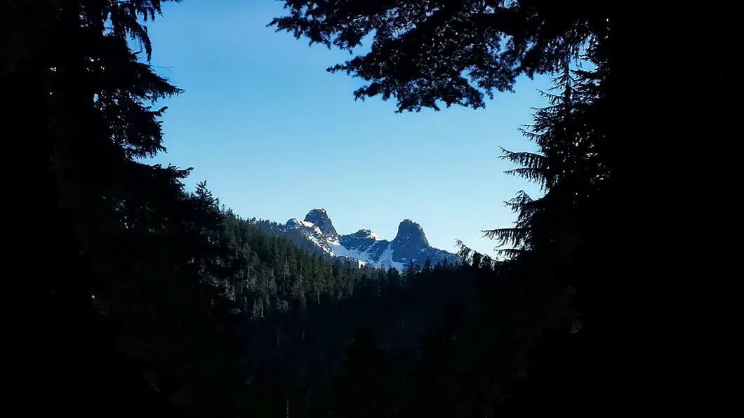
About 1.6 km into the hike you will come to a large junction with a Cypress Provincial Park map. If you took the Howe Sound Crest Trail ‘West’ at the water tower, this is where you will join back up with the East trail. Going left here will also take you to Bowen Lookout, which you can do on the way back to the parking lot. Very soon after this junction there is a spectacular view of The Lions through a clearing in the trees.

Following the trail, at about 2.5 km in, you will come into a meadow. There is a tiny bridge taking you over Montizambert Creek. You will see Mount Strachan looming above to the right. Leaving the meadow, the trail will steepen as you navigate some switchbacks. At the 3 km mark, the trail flattens some, but the trail is much more technical (rooty, rocky and difficult to find footing) than the first portion of the hike. Because of this, the second-half of the trail to St. Mark’s Summit will be a lot slower going.
3.7 km into the hike you will find yourself on a ridge, with partial views of Howe Sound to the left, and mountains to the right. Keep going along the trail, and get ready for the most difficult section of the trail to St. Mark’s Summit.
From here, the trail begins to climb steeply, and remains muddy for much of the hiking season. The end is near, however, so keep grinding up the trail until you reach the Saint Mark’s. You’ll know you are there where the trail levels out and you can see The Lions in the distance. There is also a trail marker indicating you’ve reached St. Mark’s Summit.
Download the PDF version of this guide for offline use

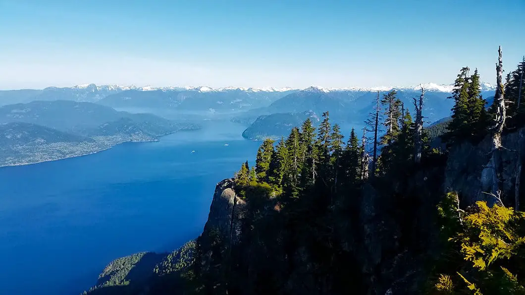
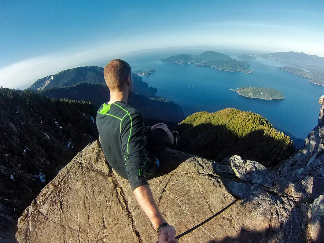
It’s a short scramble up the rocks on your left to take in the incredible scenery. Your efforts are rewarded with one of the most spectacular views of Howe Sound you can find anywhere.
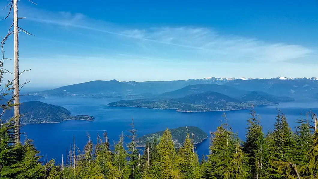
From St. Mark’s Summit, you can see all the Howe Sound islands (Bowen (Mount Gardner), Gambier, Keats, Bowyer, Anvil and Passage islands). You can also see the glaciers of the Tantalus Range and, on a clear day, you can see Vancouver Island.
To your right you will notice a rocky outcrop. You can carefully navigate your way down to that point for a slightly different perspective of Howe Sound, and a better look at Horseshoe Bay and the Sea to Sky highway.
After you’ve had a chance to enjoy the scenery, you can retrace your steps to the parking lot, this time taking the junction to Bowen Lookout and returning via the Howe Sound Crest Trail West.
If you were to continue on northward from St. Mark’s Summit along the Howe Sound Crest Trail, you would reach Mount Unnecessary and The Lions.

Directions and Parking
The hike to Saint Mark’s Summit starts from the Cypress Mountain parking lot. Take Highway #1 West and take Exit #8 onto Cypress Bowl Rd. Follow this highway for 15 kms to the downhill ski parking lot.
Google Map directions are here.
Other great hikes in this area
- Hiking the entire Howe Sound Crest Trail (very difficult)
- Hiking Black Mountain and Eagle Bluffs (moderate)
- Mount Strachan (moderate)
- View all the hiking guides here


Jared
Went weds Sept 5 . This day felt like the perfect day to go. Smog was mostly clear this time but still a little haze. But still breath taking views!!! Would go again! Definitely an intermediate hike, a younger adult crowd and it wasn’t busy at all when we went (2pm) . It took us a little over 3.5 hours round trip with hiking poles (totally reccomend poles for people with bad knees / previous injuries/ or fit seniors, my friend had a broken femur from years ago and we both felt achey knees on the descent back down , so glad we had them). Saw ravens, whiskey Jack’s, and chipmunks. Beginning had a lot of roots and rocks and switchbacks, hiking shoes are recommended. The top part is one of the harder climbs but worth it. Some mosquitos and bugs especially near 6pm but otherwise not too bad at that time of year, bug spray wouldn’t hurt but not required. Could see the Lions as well! We didn’t make Bowen look out but will next time I go again!
Sofia
Thanks for your comments./input. We are planning to go this weekend. This helps a lot.
Raj
Is there snow at this hike now?
Karl W
Yes, it is higher than the nordic ski areas. You are allowed to camp, but there are no campsites, so you’d just have to find a good/safe spot.
From BC Parks (Note that these are actually further along the HSCT, carrying on beyond St. Marks Summit):
There are 4 preferred sites along the Howe Sound Crest trail.
Plateau above Enchantment Lake (11 km from Cypress Mountain Resort);
Magnesia Meadows (14.5 km from Cypress Mountain Resort );
Brunswick Lake (19 km from Cypress Mountain Resort);
Deeks Lake (22 km from Cypress Mountain Resort).
M
Hi,
Is Saint Mark’s Summit higher than the alpine/nordic ski areas? Can you camp there?
Thanks,
M
Karl Woll
Updated comment: Details are here: https://www.outdoorvancouver.ca/featured-trail-howe-sound-crest-trail/
Wilderness, backcountry or walk-in camping is allowed at higher elevations beyond the alpine and Nordic ski areas and along the Howe Sound Crest Trail, but no facilities are provided.
There are 4 preferred sites along the Howe Sound Crest trail.
* Plateau above Enchantment Lake (11km from Cypress Bowl);
* Magnesia Meadows (14.5km from Cypress Bowl );
* Brunswick Lake (19km from Cypress Bowl);
* Deeks Lake (22km from Cypress Bowl).
Tent pads or sites are not provided. Campers are encouraged to camp in cleared areas as to limit environmental impacts. The backcountry of Cypress provincial park can be rugged, and weather is often severe. Campers should be experienced in the backcountry and prepared for all weather conditions. Campfires are NOT permitted. Backcountry winter camping (1 km beyond alpine and Nordic ski areas) is allowed. No facilities are provided. Backcountry travelers are encouraged to use extreme caution in avalanche terrain. Travellers should refer to the Cypress Provincial Park Winter trail report (at the top of the page) for updated information on backcountry trails and avalanche conditions.
If you get up there let me know! Good Luck!
Karl Woll
You know I’ve wanted to do that exact hike for a while. The views would be amazing with some nice weather.
I don’t think it gets very difficult, but definitely becomes an overnight hike, so you’d have to haul the tent/ gear. From what I’ve read about st. Marks to the Lions is there are some sketchy sections, particularly with snow. Going in late July/ August is probably your best bet.
From the Lions, I believe it would carry down then cut under Brunswick mountain towards Deek’s lake, the trailhead to which comes out right near Porteau….
Honestly, I don’t have a good description of the trail for you… but let me do some digging over the next few days… and see if I can piece something together… If not It’ll just be more motivation to do it myself!
Cheers
christophe
I have been to St marks a few times, but would like to go all the way to porteau cove, hard to find info after st marks, how difficult does it get after that ? is there any actual climbing up rope and ladders? Is there a few places along the way to camp? any comments welcomed.
Thanks for your time.
Jamie
Hey Christophe. This link to another section of this site describes the entire hike along the Howe Sound Crest Trail, which extends from Cypress to Porteau Cove – https://www.outdoorvancouver.ca/featured-trail-howe-sound-crest-trail/#comments
Check it out!