Table of Contents
- Hike Introduction
- Hike Statistics
- Map and Elevation
- Hiking Route Description
- Directions and Parking
- Hike rating
- Free PDF Download
Upper Shannon Falls Hike Intro
As of June 17, 2022, a free day-use pass is required to visit Garibaldi Provincial Park, Golden Ears Provincial Park, and Joffre Lakes Provincial Park. Passes are available to book starting at 7 am, two days in advance of your planned visit.
Day use passes are not needed when camping, in which case a camping permit is required instead.
For full details on obtaining a Day-Use Pass to access this hike, please visit the B.C. Parks website.
Upper Shannon Falls, located in Squamish, is a nice hike to get your legs going again after a long winter off from hiking. As a lower elevation hike, the snow will be gone from Upper Shannon Falls trail before many of the other tougher hikes along the Sea to Sky corridor.
Shannon Falls sits adjacent to the ever popular Stawamus Chief, within Shannon Falls Provincial Park.
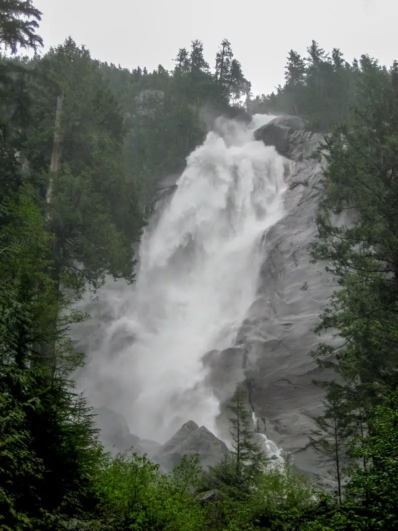
Cool Fact: “Shannon Falls is composed of a series of cliffs, rising 335 metres above Highway 99, making it the third highest falls in the province, ranking behind 481 metre Della Falls in Strathcona Provincial Park on Vancouver Island and 396 metre Hunlen Falls in Tweedsmuir Provincial Park near Bella Coola. The tumbling waters of Shannon Falls originate from Mount Habrich and Mount Sky Pilot. [source]
You can start this hike either from the Shannon Falls parking lot, or you can start from The Stawamus Chief parking lot. Both are clearly marked on the Sea to Sky highway as you drive north towards downtown Squamish. The Stawamus Chief lot has more parking available, but I recommend starting at Shannon Falls. The hike will be slightly longer, but it’s worth it to get an up-close view of Shannon Falls and to avoid a short section of the busy Chief Trail.
With the opening of the Sea to Sky Gondola in 2014, the trail beyond Upper Shannon Falls was extended, giving you the option of carrying on all the way to the Summit Lodge. The Upper Shannon Falls trail now represents the bottom section of the larger Sea to Summit Trail, and is seeing a big uptick in popularity among hikers. This trail is no longer a little-known gem. Most people now take the trail all the way to the summit lodge, and take the gondola back down.
Spring is a great time to do this hike, as that is when Shannon Falls is flowing with full force.
Upper Shannon Falls Hike Stats
Distance is from Shannon Falls parking lot (not Stawamus Chief parking lot)
Rating: Moderate
Distance: 7 km
Net Elevation Change*: 450 m
Highest Point: 500 m
Time Needed: 4 Hours
Type: Out-and-back
Season: March to December
Dogs Allowed: Yes
Est. Driving Time from Vancouver: 60 Minutes
Trailhead Coordinates (Shannon Falls parking lot): 49.671989, -123.160076
*For a better understanding of the stats and difficulty rating, check out the Hiking Guides page for details. Always carry The Essentials and fill out a trip plan.
Upper Shannon Falls Hike Map and Elevation
Upper Shannon Falls (one-way)
Profile
Upper Shannon Falls Hiking Route
Starting from the Shannon Falls, take a few pictures of the massive 335 m waterfall, which is the 3rd tallest in British Columbia.
From the base of Shannon Falls, look for the signs pointing you towards The Stawamus Chief and The Sea to Summit Trail. If you see signs for the Sea to Sky Gondola, ignore them as that direction will take you to the gondola itself, and not the trail you want to be on. It’s a quick walk to reach Oleson Creek. Cross the bridge over the creek, and you will join The Chief/ Sea to Summit Trail, just above the trail where it starts at the Stawamus Chief parking lot.
Turn right onto the trail once you cross over Oleson Creek, and begin climbing up the steep trail. If you’re hiking on a weekend, you’ll likely be joined by throngs of other hikers making the trek up to The Chief. Don’t worry, as you will soon exit The Chief Trail onto the Upper Shannon Falls/ Sea to Summit Trail, and the crowd will thin out considerably.
You will begin to see ‘Sea to Summit’ trail markers – large green diamonds – which start at #1 and go up to #400 at the Sea to Sky gondola summit. Fear not, as you’re not going all the way to the summit on this hike. However, you will follow these markers all the way to Upper Shannon Falls.
Continue climbing up the wooden stairs and steep trail until for about 30 minutes, until at about 280 m elevation, you see a junction marked for Upper Shannon Falls (along with Sea to Summit Trail). Follow the signs to the right and away from the crowd and back in the direction of Shannon Falls. From this junction it takes about 45 minutes to reach the upper falls. Crossing the bridge, once again over Oleson Creek, this portion of the trail is fairly flat and gives you a nice chance to catch your breath before it takes a brief, but sharp turn uphill again.
Download the free PDF version of this guide for offline use

Making your way through the forest of alder, you will reach a clearing where the Sea to Sky Gondola zooms overhead. There’s a nice view of Squamish and Howe Sound from here, and you can also wave at the gondola passengers as they fly overhead.
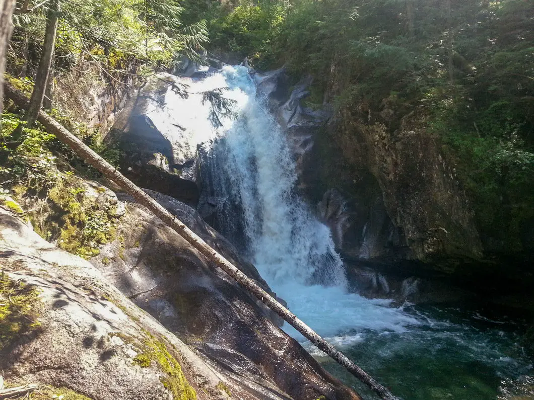
The trail continues to wend through the trees and at several sections you will be assisted by wooden ladders, chains and handrails. The trail drops into a narrow and interesting little gully, before one final climb will to you to the upper falls. You will know you’re close when you can hear the thunderous Shannon Falls Creek tumbling down the mountain.
Be careful near the powerful creek’s edge, because a slip would have disastrous results. After you’ve looked at the waterfall, follow the trail back into the woods for about 15 minutes to a nice viewpoint. Here, there is rocky outcrop that provides a great view of Squamish below you, and the Stawamus Chief just north of you. Just as importantly, you’ll have a nice place to sit, eat, and regain your energy before retracing your steps back to your car.
As mentioned, if you want to carry along the trail from here, you can do so to reach the Sea to Sky Gondola summit lodge via the Sea to Summit, Wrinkle Rock, or Shannon Basin Trails. More details on that route can be found here.

Directions and Parking
Take Highway #99 heading north past Horseshoe Bay towards Squamish. Keep driving along the Sea to Sky highway all the way towards Squamish for about 35 minutes. Watch for the signs for Shannon Falls, and simply pull into the lot right off the highway! You can also park at the Stawamus Chief parking lot about 1km further up the highway.
Google Map directions are here.
Help Us Create New Hiking Guides!
Advertising revenue is falling quickly across the internet, and independently-run sites like Outdoor Vancouver are hit hardest by it. We are committed to keeping Outdoor Vancouver free and independent, but we need to find other ways to continue operating this site.
If you like our hiking guides and would like to help, please consider making a contribution with the PayPal or Patreon links below – any amount helps! There is also a list of other ways you can support Outdoor Vancouver here!
Becoming a Patron through Patreon unlocks membership benefits and rewards. Learn More.
A one-time donation through PayPal helps with monthly website hosting costs.
Other great hikes in this area
- Al’s Habrich Ridge (moderate)
- Hiking the Sea to Summit Trail (moderate)
- Hiking the Stawamus Chief (moderate)
- View all hiking guides here


Tomina
Upper Shannon statistics are misleading and this is not a “moderate” trail – It is now advanced! After 10 years, the trail has now degraded and there are sections now that are so sketchy and steep, that markers now have to show a route (not a trail) going up about every 10 feet. Not for descending. Ropes: at least one of them I has a huge overhanging rock and rough stuff steeply below.
The posted elevation would suggest a moderate climb, but since the trail is too treacherous to descend, hikers now, all but the most experienced, go to the top, and the gondola, a full 3000 feet elevation gain..We went last week, and no one descended and the locals warned us off trying.
This is an advanced hike for the well experienced only.
Tombert
Gorgeous, the upper falls has a totally different feeling, and you can get really close to it. Don’t get to close to the stream farther down… as it is hazardous. Only the beginning is really steep, other that that it is pretty moderate… the falls are pretty easy to miss, we went further, and checked out the view, and came back down… and hopped around upstream, until we found the falls. Beautiful
VancityAllie
Shannon Falls is definitely beautiful. I can’t recommend this trail enough! :)
VancityAllie’s last blog post..A SURFING LONG WEEKEND IN TOFINO
Karl Woll
It’s actually not that tough to do both in the same day! I’ve done peak 2 and 3 of the Chief and then Upper Shannon Falls, although I can’t remember how long it took, probably 6-7 hours. I do remember being exhausted though!
Karl Woll’s last blog post..Featured Trail: Upper Shannon Falls
Tyler
I’ve always wanted to hike to the stop of Shannon Falls and the Chief actually. Perhaps this year we’ll have time to actually do both!
Tyler’s last blog post..Whistler Whiteout