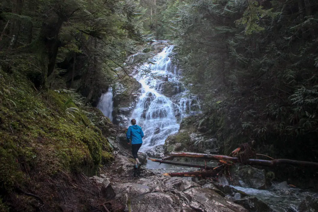
Kennedy Falls Hike – Table of Contents
- Hike Introduction
- Hike Statistics
- Kennedy Falls Video
- Map and Elevation
- Hiking Route Description
- Directions and Parking
- Free PDF Download
Kennedy Falls Hike Intro
The hike to Kennedy Falls (or Kennedy Creek Falls) in North Vancouver has several key selling points. First, it’s a relatively unknown spot and you can avoid crowds (although the trail is becoming increasingly popular). Second, you have several options about the exact route you take (if Lynn Creek is low enough you can make this hike a loop from a few different spots). And third, the hike features two incredible landmarks.
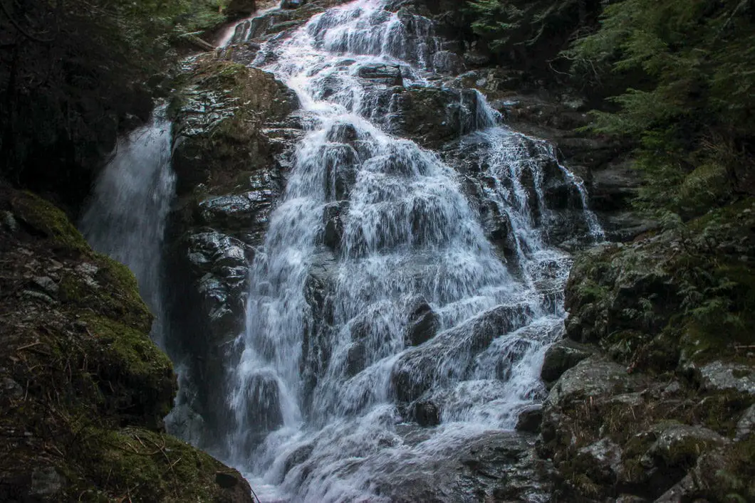
The first landmark is a 600+ year old red cedar, that is one of only a few old-growth trees in Lynn Valley to have escaped being clear-cut. At 4 meters wide, it’s arguably the most spectacular tree you can find anywhere around Vancouver. The second landmark is Kennedy Falls itself, seeing the impressive cascade of water coming from Kennedy Lake towards Lynn Creek.
The trail stays at a low elevation and is usually snow-free all year. While there isn’t a lot of elevation gain, the trail is quite technical in spots, and can be slow-going.
It is rated as difficult because Search and Rescue has seen a high volume of callouts on this trail for people getting lost.
Note: This trail has become much more popular in recent years. It appears the soil around the Big Cedar is eroding and this is putting the tree’s survival at risk. Please refrain from getting too near to the tree to help protect it. More details can be found on the BC Tree Hunter website.
Big Cedar Trail and Kennedy Falls Hike Stats
Rating: Difficult
Distance: 10 km
Net Elevation Change*: ~150 m
Highest Point: ~500 m
Time Needed: 4 to 5 hours
Type: Out-and-back
Season: Year-round
Dogs Allowed: Yes
Est. Driving Time from Vancouver: 30 minutes
Trailhead Coordinates: 49.354995, -123.037116
*For a better understanding of the stats and difficulty rating, check out the Hiking Guides page for details. Always carry The Essentials and fill out a trip plan.
Kennedy Falls Video
Here is a 2-minute video of our experience on this hike!
Kennedy Falls Map and Elevation
Kennedy Falls (one-way)
Profile
Kennedy Falls Hiking Route
The hike to Kennedy Falls has several options, as seems to be the case with many of the North Shore hikes. I’ll explain a few of the other options at the bottom of this guide. But to start out with, I will describe the hike from most direct and easiest route – starting at the Old Mountain Highway gate near the Baden-Powell trail junction. Wherever you actually park and start from will be added distance and time to the hike summary stats above.
Walk north up Old Mountain Highway from the parking lot and you will very quickly come to a pit toilet and most-likely a group of mountain bikers preparing for a day of riding around the Mount Fromme trails.
Once you pass the gate by the bathrooms, continue up Old Mtn Hwy about 500 meters until you approach the first switchback. Before the actual hairpin turn of the road, there is a gravel trail dropping down to your right, marked as Cedar Tree Trail. Take that trail, and follow it to the left. After a few minutes you’ll come to a junction marked to the left for Kirkford trail (this junction is referred to as Crinkum Crankum trail in other online resources). Stay right at the Kirkford trail junction, and there really aren’t too many other junctions you can take to get lost. While the trail is never clearly marked at this junction ‘Big Cedar Trail’ or ‘Cedar Tree Trail’, you are on it.
Almost immediately past the Kirkford trail junction, you’ll cross over a small creek. Get used to this, as you will pass over nearly a dozen different streams/creeks along the way to Kennedy Falls. They vary in size, but suffice it to say that access to drinking water is not an issue on this hike, and depending on the season you are hiking, trying to keep your feet dry may be an exercise in futility. The entire trail from here is marked well with yellow markers in the trees.
Download the free PDF version of this guide for offline use
While the trail to Kennedy Falls is well-established, depending on when you go and when trail maintenance was last done, there could (likely, will) be considerable deadfall (including the demise of some of those yellow markers). Essentially, you just want to keep a north heading on the trail, making sure you at least periodically see a yellow marker. There may be a few sections throughout the trail which briefly divert due to deadfall, but it should be easy enough to navigate these short sections back to the main route.
The trail rolls up and down as you make your way through the woods. At about the 3.5 km mark of the hike, you’ll come around a corner in the trail and the massive big cedar itself will catch your eye.
The size of this tree has to be seen to be believed. Its worth spending some time here in awe of the giant. For some, this is the end of the hike, a turnaround point back to the car. Just off to the east (right) of the tree, towards Lynn Creek, you will find a steep trail which makes its way down to the creek itself (for a possible crossing of the creek, and creating a loop back to Lynn Headwaters). This is a good spot to grab a snack before carrying on to Kennedy Falls.
Cool fact: “Lynn Valley, North Vancouver reportedly once contained the tallest trees on Earth. The entire valley bottom was clear-cut except for this single 4 m wide cedar.” 1
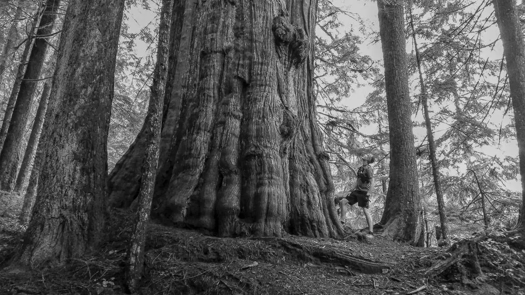
The trail to Kennedy Falls picks up behind the massive cedar, to the northwest (left), direction and climbs uphill. The next 1.5 km of the trail will be much like the first stretch, will some rolling ups and downs, and several creek crossings. Along the entire trail, but particularly during this final stretch before Kennedy Falls, you’ll see the stumps of many other giants which were chopped down long ago, marked with the signature springboard holes of the logging method of the day. You will also find at points of the trail that you are on the remnants of an old logging skid road, which was built by Julius Fromme’s logging company in the 1920’s.1
The trail will do one final dip down and you’ll hear the rushing water of Kennedy Falls, hidden just around the bend. From here you can enjoy the waterfall and get some photos and a snack before re-tracing your steps back to your starting point. If you wish to look at the upper falls, it is possible, but it is not recommended you scramble up the rocks directly alongside the falls as they are very loose and unstable.
Alternative Routes for Kennedy Falls Hike
As mentioned at the top, there are some options with this hike. As far as starting your hike goes, the Old Mountain Highway gate off McNair Drive is the most-straightforward. You can also connect from the Baden-Powell trail by parking at Lynn Headwaters Regional Park. From Lynn Headwaters, you can come up the Baden-Powell, all the way to Old Mtn Hwy, or branch off onto Lower, Middle and Upper Griffen trails, which connects directly to Big Cedar Trail near the Old Mountain Highway switchback.
This hike can also be made into a loop, **if Lynn Creek is low enough to be safely crossed**. However, this way is a bit more advanced and requires some route-finding. I have not personally hiked to Kennedy Falls by crossing over Lynn Creek as of yet, but there are trails that will connect you down to Lynn Creek from both the ‘Big Cedar’ and from Kennedy Falls. This can, obviously, be done in either direction.
It seems crossing from the Big Cedar Trail side over to the Cedar Mills Trail side would be easier, as finding Cedar Mills Trail from Lynn Creek is impossible to miss. However, looping from the Cedar Mills Trail side over requires a bit of planning in terms of where to split off and cross. Heading to the Big Cedar tree, you would look out for Bridge #52 on Cedar Mills trail and a nearby ‘hidden’ path to the creek, before crossing over and picking up the trail on the other side.1
If looping directly to Kennedy Falls, you go to the Third Debris Chute and cross over, before climbing up alongside Kennedy Creek. As mentioned, I have not looped this trail at this point, so you will need to look at the Club Tread forums or other sources for more exact advice on this.
Directions and Parking
Keep in mind that the parking lot is gated. If you will be hiking beyond the gate-closure hours, you’ll need to park down in the residential area, which can be tricky. It is resident-only parking on McNair Drive, Hoskins Road (above Coleman St.) and along Coleman Street. If you park on these streets, you risk being ticketed. Dempsey Road is your best bet for parking, and you can get an idea of the parking restrictions in this map from NSMBA.
If you are coming over the Second Narrows Bridge from Vancouver, take Exit #21 and follow Mountain Highway north towards Mount Fromme. If you are coming via the Lion’s Gate Bridge, take Marine Drive east towards Capilano Rd. Take Cap Road north to the Highway #1 east. From Hwy 1, exit onto Lynn Valley Rd, and turn north onto Mountain Highway and follow it up towards Mount Fromme.
Google Map directions are here.
Other great hikes in this Area
- Hiking Norvan Falls (moderate)
- Hiking the Hanes Valley Loop (difficult)
- Hiking Lynn Peak (moderate)
- View all hiking guides here






Elena
The trail to Kennedy Falls is now well marked with orange markers.
Karl W
Thanks – this guide was written several years ago so we should probably hike it again and update!
Nev
Park was closed on Mar 10, 2019. Lots of snow everywhere.
Terence Chan
I really enjoyed the Kennedy falls hike. Its a trail for people who likes hiking. The terrain is wonderful because it has a combination of varieties. However, the trailhead should have a better indication to help the first time hikers to Kennedy Falls for their start. 2018-07-29
Ryan
Despite the many trail markings and flagging on this trial, NSR continues to receive SAR calls for hikers who have lost the trail and become lost. Please take extra care when on this hike and pay particular attention to the markers. And, of course, carry the 10 Essentials, leave a trip plan (don’t expect to have cell coverage, so having someone expecting you back who can raise the alarm when you’re not is essential), and ensure you research current trail conditions.