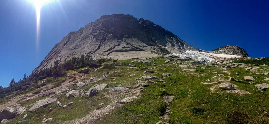
The sub-summit of Yak Peak. Photo Credit: Emily Masse
Table of Contents
- Hike Introduction
- Hike Statistics
- Map and Elevation
- Hiking Route Description
- Directions and Parking
- Free PDF Download
Yeak Peak Hike Intro
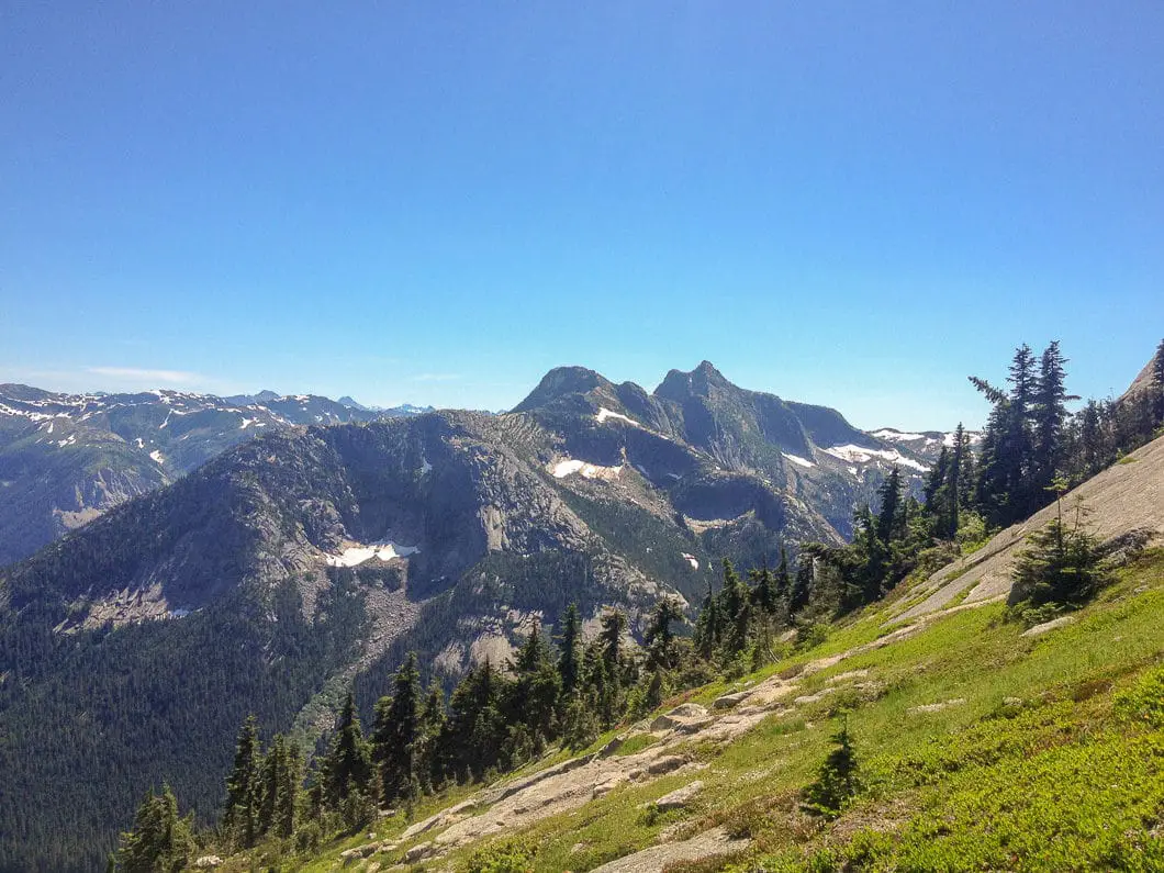
Yak Peak, located in the Coquihalla Summit Recreation Area, is a steep, granite peak, and has the highest summit on the Zopkios Ridge. Visible from the Coquihalla Highway, Yak Peak is located in the Cascade mountain range and is popular for hikers and climbers alike. Yak offers an arduous uphill climb with beautiful panoramic views of nearby Needle peak, Vicuna and Guanco peaks, among many more!
This is technical, steep climber’s trail and should only be undertaken by experienced hikers. Also, wild swings in weather conditions are par for the course in the Coquihalla Summit Recreation Area – be prepared! Wind, snow, rain and fog can quickly sweep in almost any time of the year here.
Yak Peak Hike Stats
Rating: Difficult
Distance: 5.5 km
Net Elevation Change*: 829 m
Highest Point: 2,039 m
Time Needed: 6 – 7 hours
Type: Out-and-back
Season: July – October
Dogs Allowed: Yes
Est. Driving Time from Vancouver: 2 hours
Trailhead Coordinates: 49.59529, -121.10656
*For a better understanding of the stats and difficulty rating, check out the Hiking Guides page for details. Always carry The Essentials and fill out a trip plan.
Yak Peak Map and Elevation
Yak Peak
Profile
Yak Peak Hiking Route
The trailhead is less than 1 km from the Zopkios Rest Area on the Coquihalla Highway, near where the old tollbooth was. Parked at the rest area, walk east along the highway for about 800 m. Once you reach the cement barrier, count 5 lamp posts. At the fifth lamp post look left down the slope and you will see a cairn with some flagging tape.
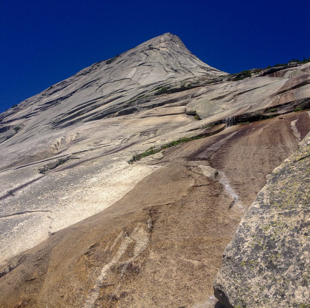
This marks the trailhead. You will follow this over a small creek and through a swampy area until you find yourself in the trees. The trail climbs steeply through the trees for around one hour before meeting the large granite slab face near “Yak Crack” (popular to climbers). Proceed with caution if there are climbers above. Follow the talus until the trail moves through some heather and alder.
Cool fact: The Coquihalla Valley has long served as the major transportation route from the coast to the interior beginning with the Hope-Nicola Trail in 1876. The Coquihalla Summit Recreation Area still contains some remnants of the Kettle Valley Railway which ran through the area from the early 1900s through to 1961. [source]
The trail climbs beside the granite face offering seasonal runoff streams and a perfect place to splash your face! Embrace it. The trail continues up, moving away from the main granite face to a smaller granite face and a boulder field for a couple kilometers. This portion proved to be difficult for my large breed canine friend. As the trail opens, large cairns and flagging keep you on track.
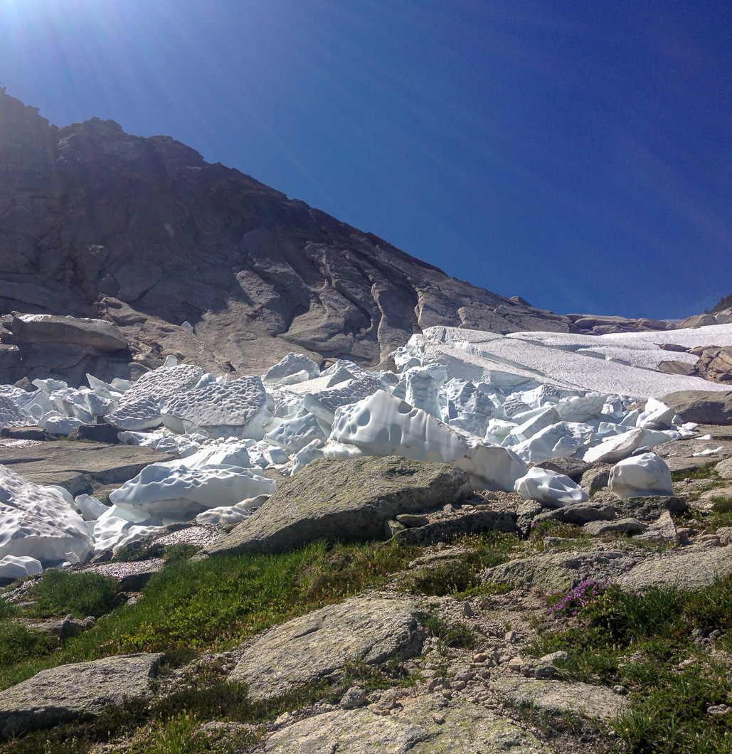
Once you have passed this, the alpine meadow will be visible. This trail before the col between Yak and Nak Peaks offers beautiful panoramic views, runoff water, and perma-snow. Before the Yak-Nak col, the trail veers left towards the saddle for Yak Peak and its sub-summit.
For those that wish, there is a trail leading through a small snow field with a scramble up some loose rock to the summit of the peak. The size of the permanent snowfield can vary from year-to-year, but should be attempted only by those with experience as it is steep and slip could result in serious injury. If the field is icy, creating kick-steps may prove difficult and an ice ax may be required. You may also be able to scramble around the steep rock on the edge of the snowfield.
Beyond the snowfield, an easy scramble remains to take you to a col between the sub-summit and the true summit. The sub-summit (to the left) takes you to the very edge of a sheer 500 m cliff, and the summit (to the right) provides a spectacular panorama of the surrounding area, including Needle Peak. Obviously, much caution must be undertaken for those wishing to travel to the true summit.
Download the PDF version of this guide for offline use
Directions and Parking
Getting to Yak peak is about a 2 hour drive from Vancouver, 40 minutes from Hope, or 40 minutes of Merritt. Driving east on the Coquihalla highway (north from Hope), take exit 217 for the Zopkios Rest Area. This rest area is shortly after the Great Bear Snowshed. After taking the exit, turn left through the tunnel under the highway. There is parking at the rest stop. From here, walk east about 800 m to the trailhead (marked by some small cairns).
Google Map directions are here.
Help Us Create New Hiking Guides!
Advertising revenue is falling quickly across the internet, and independently-run sites like Outdoor Vancouver are hit hardest by it. We are committed to keeping Outdoor Vancouver free and independent, but we need to find other ways to continue operating this site.
If you like our hiking guides and would like to help, please consider making a contribution with the PayPal or Patreon links below – any amount helps! There is also a list of other ways you can support Outdoor Vancouver here!
Becoming a Patron through Patreon unlocks membership benefits and rewards. Learn More.
A one-time donation through PayPal helps with monthly website hosting costs.
A few other challenging hikes
- Hiking Black Tusk (difficult)
- Hiking Hanes Valley (difficult)
- Hiking Mount Bishop (difficult)
- See all hiking guides here.
 Post Author: Emily Masse
Hiker. Outdoor enthusiast. Geography student. Dog lover. Rock hounder. Not so closet, closet nerd. Explorer. Walking sticky note.
Website.


Jill
Can you camp up there?