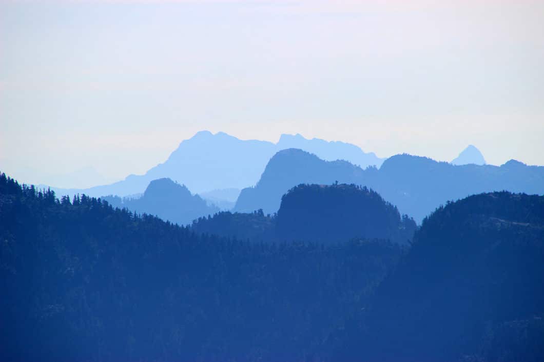
Mount Strachan Hike – Table of Contents
- Hike Introduction
- Hike Statistics
- Mount Strachan Loop Video
- Map and Elevation
- Hiking Route Description
- Directions and Parking
- Free PDF Download
- 360° Photosphere
Mount Strachan Hike Intro
Mount Strachan in West Vancouver gets less attention than the other hikes in Cypress Provincial Park. While nearby hikes like St. Mark’s Summit and Eagle Bluffs draw big crowds, the trail to Mount Strachan sees fewer hikers. But, anyone who has hiked this loop will tell you the views are as spectacular as any other hike in the park.
There are probably a few reasons Mount Strachan’s lack of popularity. For one, the trail isn’t prominently marked like the other trails within Cypress. For another, the trail is steep and difficult in sections. Route-finding is difficult in other sections. Snow starts early in the winter and persists late into the year. When there is snow, avalanche risk exists. And bears are common in this area outside of winter. All of which means this is not a route for the inexperienced hiker.
But Mount Strachan rewards anyone willing to put in the effort.
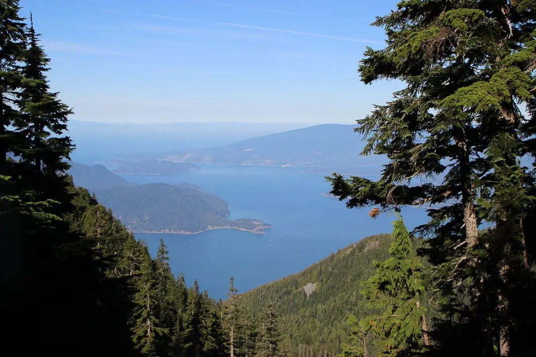
The trail begins on along the Howe Sound Crest Trail en-route to St. Mark’s Summit. The Mount Strachan Trail then deviates up to two separate peaks – both offering gorgeous, yet unique views. The North peak offers a panoramic view of The Lions and the Sea to Sky mountains as far north as the eye can see. The south peak offers views of Howe Sound itself.
Finally, on the descent back to the parking lot, you pass by an airplane wreck memorial site for the Royal Canadian Navy T-33 Jet, which crashed in 1963.
Mount Strachan Loop Stats
Rating: Moderate
Distance: 10.5 km
Net Elevation Change*: 525 m
Highest Point: 1,440 m
Time Needed: 4-5 Hours
Type: Loop
Season: July to October
Dogs Allowed: Yes, on-leash
Est. Driving Time from Vancouver: 30 Minutes
Trailhead Coordinates: 49.397585, -123.205468
*For a better understanding of the stats and difficulty rating, check out the Hiking Guides page for details. Always carry The Essentials and fill out a trip plan.
Mount Strachan Video
Here is a 1.5-minute video of our experience on this hike!
Mount Strachan Loop Map and Elevation
Mount Strachan
Profile
Mount Strachan Hiking Route
Strachan is most commonly hiked in a clockwise loop starting from the Cypress Mountain Resort parking lot.
The hike to Mount Strachan begins at the parking lot for the Cypress Mountain ski resort (downhill skiing area). There is a sign marking your elevation here at 915 m and a Cypress Provincial Park signboard and map.
From the parking lot, walk to the large Cypress Creek Lodge. Once you’re in front of the lodge, you’ll see the Lions Express Quad Chairlift. Near the bottom of the chairlift is a marker for the Howe Sound Crest Trail. Follow the marker for the Howe Sound Crest Trail onto the path and into the trees.
Immediately after the path begins there is another junction. The marker will tell you to go right for Howe Sound Crest Trail but stay straight in the direction marked for Bowen Lookout. The route to Bowen Lookout is slightly more scenic and ends up in the same place.
Soon, you will come to another junction with another chairlift on your left – the Eagle Express Quad Chair. Keep going straight and you will come to a meadow. Go right at the junction here marked for Bowen Lookout. The trail will take you into the forest. After a quick climb, you’ll see yet another marker directing you towards Bowen Lookout (1.2 km away) and the Howe Sound Crest Trail. Follow the sign.
You will pop out onto a gravel road. Go left onto the road. The road is flat, carries over a small stream and then begins to climb uphill again.
About 2 km into the hike, you come to the Bowen Lookout detour. The detour will add minimal distance (~500 m) to the hike, so it’s worth going to check it out if you haven’t been before.

After taking the detour to Bowen Lookout, come back to the junction and head left onto the trail – in the same direction you were walking before. The trail enters the forest again and climbs uphill. Once you’re up into the dense woods, the trail flattens out.
Walking up the hill, it’s not long before you hit a major junction. You’ll know you’re there as you’ll see a large map for the Howe Sound Crest Trail. Go left onto the trail. If you keep your eyes peeled through the trees ahead you’ll have a nice view of The Lions. The trail meanders up and down for a way, and you are now following the route to St. Mark’s Summit.
This is where you need to pay close attention to find the trail to Mount Strachan.
Around 3.5 km into the hike you will come to a meadow – Strachan Meadows. There are two small, wooden bridges going over a creek. The trail to Mount Strachan is off to your right between these small bridges. Between the two bridges on your right, you will see an overgrown trail into the brush. It’s hard to see but it’s there. Go right onto the trail.
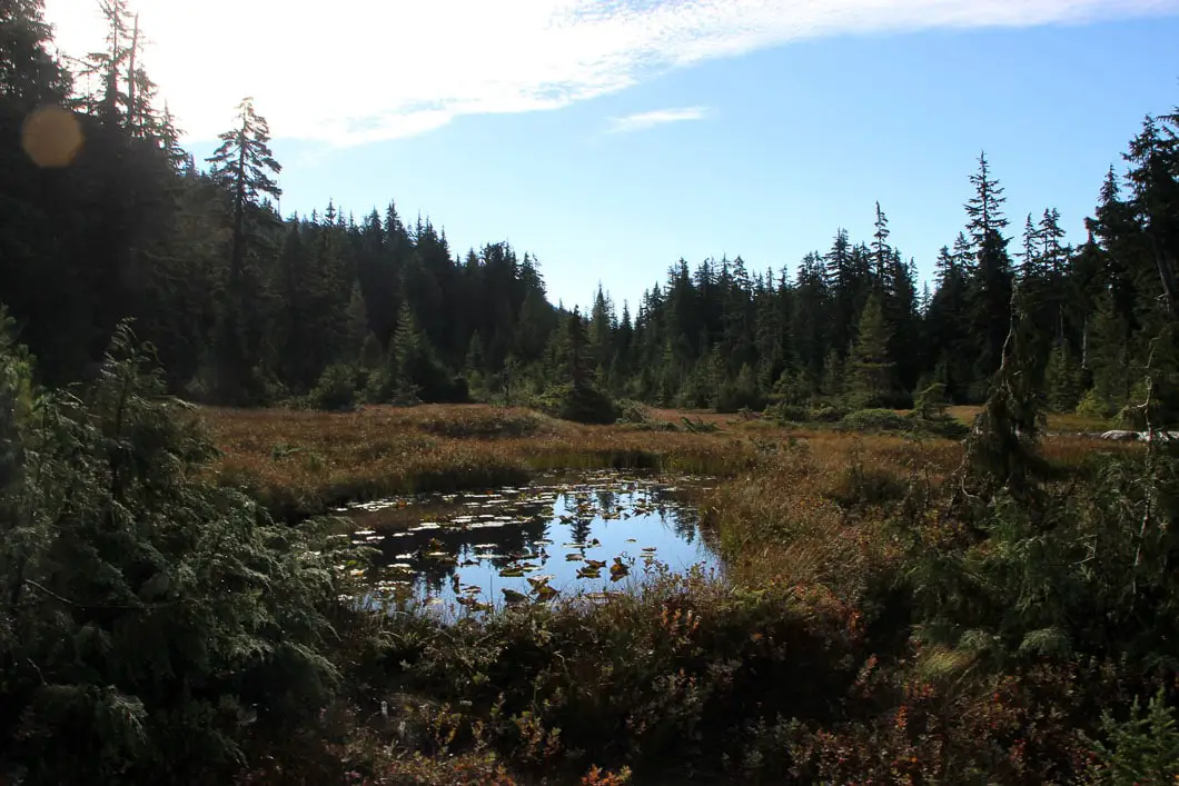
This section of trail is overgrown but you should be able to follow it and spot the odd piece of flagging on branches.
The trail will emerge to a steep climb up a wide debris chute known as Christmas Gully. You will be climbing all the way up to the top. Continually shaded by Mount Strachan’s south summit, the winter snow in this gully will persist for a long time into the spring and summer.
On your left, you’ll notice the trail cuts into the trees. Follow the trail into the trees and continue to climb parallel to the gully. After about 10 minutes, the trail will spit you back out into Christmas Gully. Climb up the gut of the gully and it will funnel you to the top. Be cautious on the large, loose rocks. Remember to stop and look at the magnificent view unfolding behind you as you approach the top.
At the top, there’s a clearing and you will be between the two summits of Mount Strachan. The north summit is to your left. Go to the north summit first. You will see orange spray paint on a rock, marking the way. It is a 10-minute scramble up steep, exposed rock. At the top, you are awarded an amazing panoramic view of the North Shore and Sea to Sky mountains. You can see Golden Ears to the east. The Lions are displayed to the north, and you can even see Mount Garibaldi behind them in the distance.

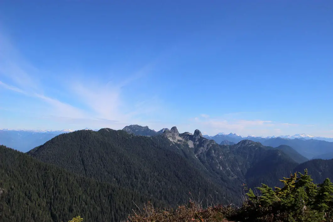
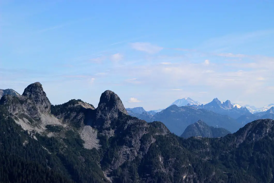
There is plenty of space to move around and enjoy the view from different perspectives. This is a good spot to have a snack and get your legs back before continuing. Be mindful of the sharp drop off the north edge of the summit.
When ready, retrace your steps back to the clearing at the top of the gully. This time head to the south peak which is now directly across from you.
It is a similar scramble to reach the top of the south summit. The south summit offers a wide-open area to soak up the view of Howe Sound. The view is not quite as spectacular as the north summit, but still remarkable.
Continuing from the south peak, find the trail on the southern side of the summit. You will come to the top of the Sky Chair chairlift.
Here, things can get interesting.
Finding the trail again from this spot isn’t always an easy task. It takes a keen eye to see the flagging. There is no single, clearly defined path. You may think you’re on the path only to find out the path ends in front of you.
The trail is down and left from the chairlift. With a sharp eye and some searching, you should find the proper trail with two orange markers. The trail dips into the trees and becomes a defined trail once you can pick it up again. The trail will begin to drop down sharply, and you will know when you are on it.
Follow the steep trail as it zig-zags down. In about 20 minutes you will find the wreckage of the T-33 military jet along the trail.

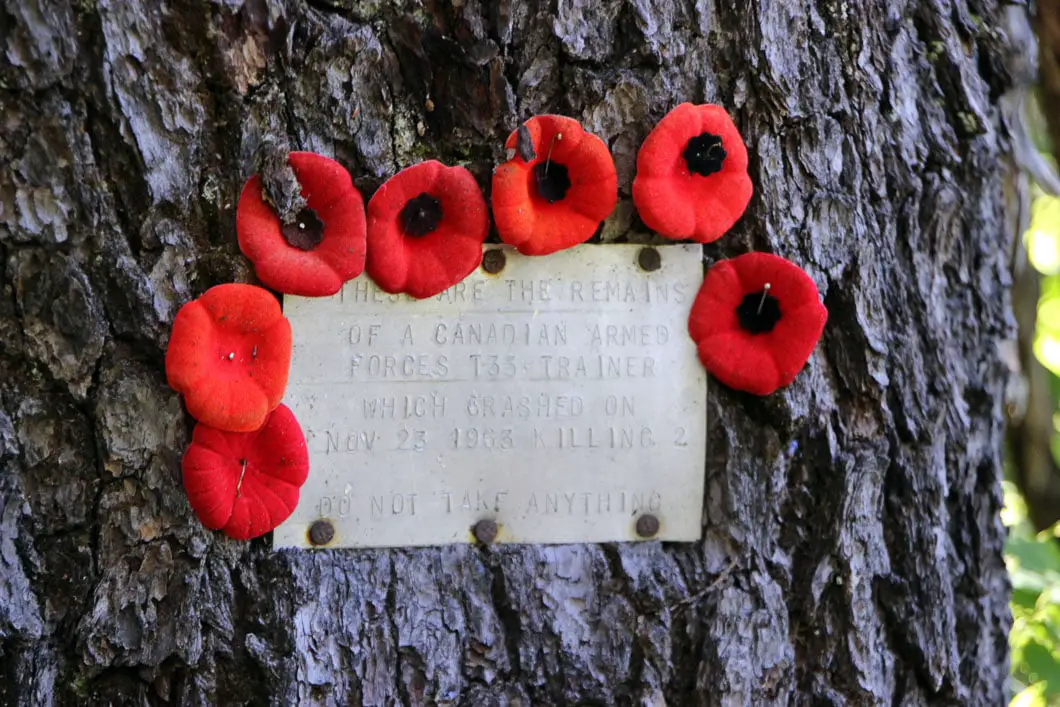
Interesting Fact: “On November 23, 1963 a Royal Canadian Navy T-33 Jet aircraft on a naval training flight with two crew members on board, crashed into the heavily forested mountainous area of Mt. Strachan in what is now known as Cypress Mountain. The two Royal Canadian Navy crew members were killed. The accident occurred one day after the assassination of American President John F. Kennedy and shared the headlines for several days as information on Lee Harvey Oswald’s Participation was uncovered. It was the height of the Cold War at this point in history, and Canadian armed forces pilots were training aggressively to be ready for any challenges resulting from the escalating political tension.” [Source: Cypress website]
This is a historical site and a memorial. Out of respect to those who lost their lives in this crash serving Canada, please do not touch or disturb any of the wreckage.
After paying your respects and observing the unique site, you can carry along the trail. Keep following the trail down for 10 minutes more. It will spit you out onto a wide gravel road/ ski run. From here you simply need to follow the gravel road back down to the lodge.
This final stretch will take you about 15 minutes and is the least interesting part of the hike. The gravel road takes you all the way back to the main day lodge area, and you’ll find the parking lot.
Note: Instead of descending the ski run/ gravel road, you can stay on the trail which continues shortly before it merges to the ski run. That way adds significant time and technical terrain to the hike. If you’re tired, just go down the ski run – you already saw 95% of the scenery.
But, if you want to hike longer, the trail will follow a ravine down until it connects with the Baden-Powell Trail, at a marked junction. The Baden-Powell trail will take you back to the Cypress parking lot. It is also possible to pick up the trail to Hollyburn Mountain from that route. But we’ll leave that for another day.
Download the PDF version of this guide for offline use
Directions and Parking
The hike to Mount Strachan starts from the Cypress Mountain Resort parking lot. Take Highway #1 West and take Exit #8 onto Cypress Bowl Rd. Follow this highway for 15 kms to the downhill ski parking lot.
Google Map directions are here.
Other great hikes in this area
- Eagle Bluffs (Black Mountain) (moderate)
- St. Mark’s Summit (moderate)
- Howe Sound Crest Trail (difficult)
- View all hiking guides here


