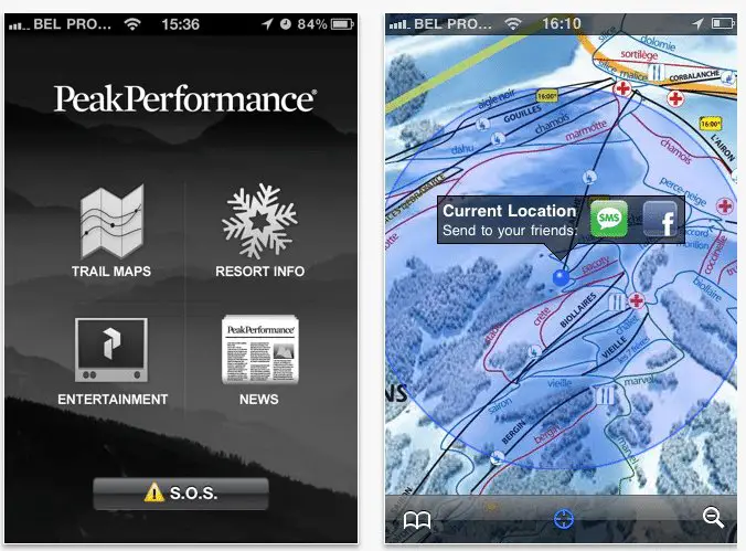
I recently caught wind of a new iPhone app that looks useful for the resort skiers and snowboarders. It’s a free app called Peak Performance Trail Maps.
The Peak Performance app is neatly designed and provides a dashboard for the ski areas of your choice, including real time weather forecasts, information on snow conditions, lifts, slopes, webcams of ski resorts and twitter feeds. No matter if you are planning to spend your snow holiday in North America, travel to an European destination or anywhere else in the world, the new iPhone app will be your best friend when you are in trouble and guarantees you won’t get lost on the slopes this winter.
Once you’ve downloaded a trial map, you can easily locate yourself and share your position with friends who also have an iPhone without consuming any data.
Furthermore there is a SOS button that can be used in case of an emergency. The app can send a text message with your exact location to any of your contacts. That way they can easily notify emergency services and communicate your exact location.
Besides the many useful features the application also contains the latest news and videos from the Peak Performance world.
The application is developed by In The Pocket, one of Belgium’s leading mobile agencies.
Download Peak Performance Trail Maps here:
https://itunes.apple.com/be/app/peak-performance-trail-maps/id410820119?mt=8
It looks pretty cool, but I don’t have an iPhone so I’m not able to test it out. I would assume it has Whistler, but I’m not sure about the other local mountains. Can anyone confirm?


