Sawblade Falls – Table of Contents
- Hike Introduction
- Hike Statistics
- Sawblade Falls Video
- Map and Elevation
- Hiking Route Description
- Directions and Parking
- Free PDF Download
- 360° Photosphere
Sawblade Falls Hike Intro
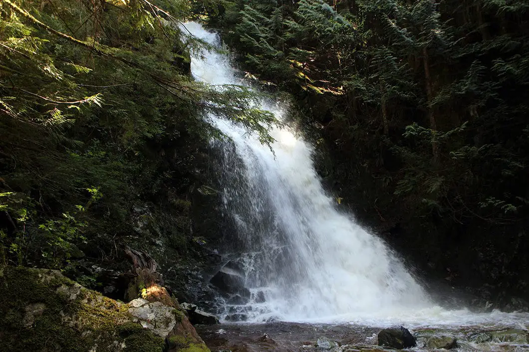
Sawblade Falls is a scenic waterfall located on Burke Mountain in Pinecone Burke Provincial Park, Coquitlam. The Woodland Walk Trail takes you 4 km up to the base of the falls. Along the way, you walk through the beautiful forest of Burke Mountain and pass by the smaller Woodland Falls.
A nice feature of the Sawblade Falls hike is that it can be completed in a loop, along the Upper Loop and Lower Loop trails to and from the waterfall.
Like most waterfalls, spring is the best time of year to go. Late in the summer of low snowpack years, the flow of the falls may be little more than a trickle. But even then, it’s a hike worth doing and the trickle of water can make for some great long-exposure photographs.
The only downside to this hike is the steady sound of gunshots echoing through the forest. They come from the nearby Port Coquitlam and District Hunting and Fishing Club. The range is open 8:30 am – 4:30 pm, daily (closed on Tuesdays). During these hours, the noise from the range can be heard well into the hike, especially along the first few kilometers.
Safety note: Be bear aware. This is true on all hikes, but Burke Mountain has a healthy bear population. Be prepared for, and know what to do in, an encounter. Dogs must be on-leash at all times within Pinecone Burke Provincial Park.
There are also many mountain bikers on the trails off Harper Road. Share the trails responsibly and be alert.
Sawblade Falls Hike Stats
Rating: Easy
Distance: 9 km
Net Elevation Change: 225 m
Highest Point: 549 m
Time Needed: 3.5 Hours
Type: Partial-loop
Season: Year-round
Dogs Allowed: Yes, on leash
Est. Driving Time from Vancouver: 40 Minutes
Trailhead Coordinates: 49.313638, -122.749260
*For a better understanding of the stats and difficulty rating, check out the Hiking Guides page for details. Always carry The Essentials and fill out a trip plan.
Sawblade Falls Video
Here is a 1-minute video of our experience on this hike!
Sawblade Falls Hike Map and Elevation
Sawblade Falls
Profile
Sawblade Falls Hiking Route
Park on the side of the road by the yellow gate (directions). Parking can be busy on the weekend with the many mountain bikers riding here.
Walk around the yellow gate and start walking up the gravel road. You can take the trail to the left of the gate (so-called “Garbage” trail) but there are many mountain bikes on that trail. It will be easier to just follow the gravel road up for the first short section of the hike.
About five minutes up the road, or 300 m, there is a junction in the road. Go left, making a hairpin turn.
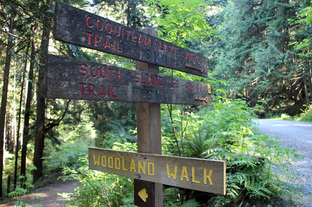
Carry on the dirt road for another five minutes and you will come to a trail that splits off to the left. The sign is marked for the Woodland Walk. To the right is marked ‘South slope to ridge trail’ and ‘Coquitlam lake view’. This junction is about 700 meters into the hike. Go left, onto the trail marked for the Woodland Walk.
The next section of the trail is flat and easy walking. In the spring, there may be some small puddles and streams. You will hear the gun range loud off to your left depending on the time of day you are hiking. You will see blue, circular markers in the trees.
After about twenty minutes from the Woodland Walk junction, or 1.75 km into the hike, you will come back out onto a dirt road, under two sets of power lines. Go left onto the road. Walk about 100 yards and you will cross a bridge over Pritchett Creek. This is the same creek that creates Crystal Falls further downstream.
Walk a couple minutes down the road and on the right, you’ll see a sign for the Upper Loop. That’s the way we will return. Instead of going on the Upper Loop, we’ll continue over to the Lower Loop.
Continue following the dirt road. As you crest the corner you’ll see Mount Beautiful, Dilly Peak, and Eagle Ridge ahead of you, across the valley. Then you’ll see a sign for Lower Loop in the trees on your right. Go right, up the trail.
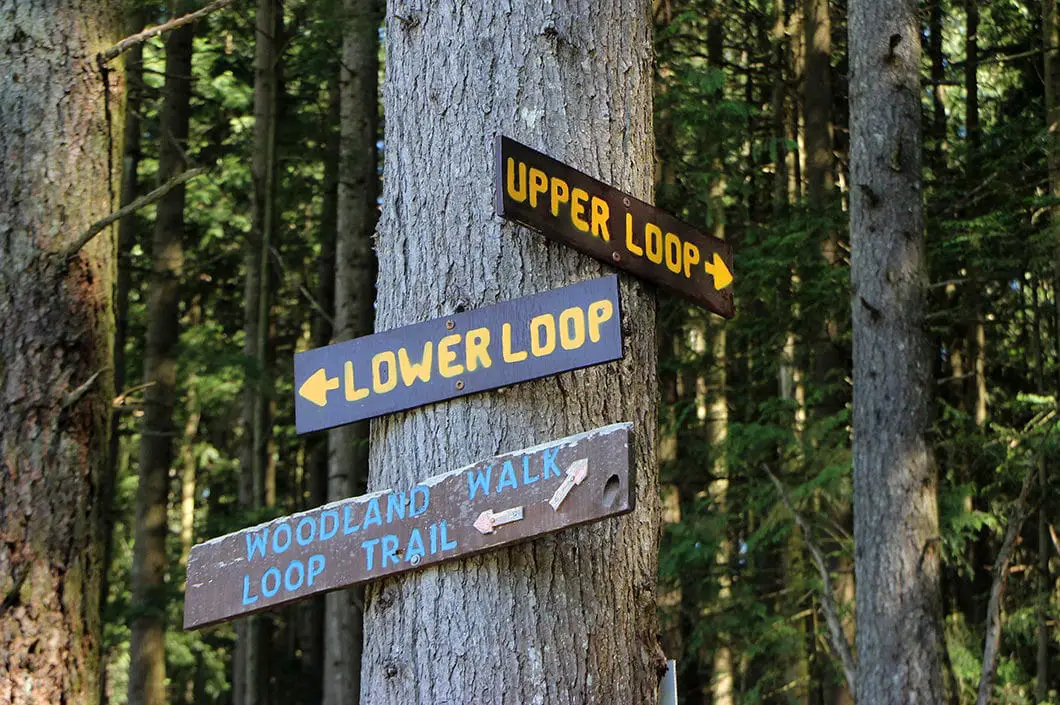
Once you’re on the Lower Loop Trail, the trail will become more rugged. At first, the trail climbs up gently with a minimal grade. There are few creek crossings and the trail continues to be clearly flagged by blue markers. The trail is well-established and easy to follow.
Roughly 3.3 km into the hike, the trail begins to climb up more sharply. This section of trail has many loose rocks and the footing becomes trickier. The Lower Loop Trail continues to climb up into the forest. A loud creek off to your left should drown out the gunshots as you walk further and further away from the gun range.
About 3.4 km into the hike, there are signs in the trees marked for ‘Falls’ in yellow text on a wooden board. Go left. Don’t go right, which would be easy to do. To the right is one of two connecting trails to the Upper Loop Trail. Be careful to look for this junction and stay left on the Lower Loop.
Soon after, you will cross over a creek and the trail begins to climb uphill again. It is rooty in this section.
At roughly 4 km, after another creek crossing, you will pass by an enormous stump from the extensive logging done to this forest long ago. The trail continues, nice and level, with easier footing in this section.
Shortly after the large tree stump, you come to Woodland Falls. It is worth a quick scramble down to the creek.
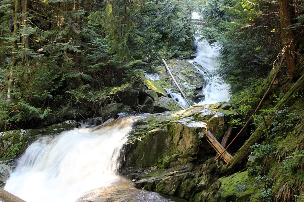
As you begin to backtrack on the trail from Woodland Falls, you’ll see the trail marked for Sawblade Falls on your left. The trail leads up a steep hill. This next section is the most difficult section of the hike.
The trail begins climbing up sharply. The trail zig-zags up and will take about fifteen to twenty minutes to reach the top.
The trail comes to a partially obstructed viewpoint at the top before it connects with the Upper Loop Trail. Follow the signs for Sawblade Falls.
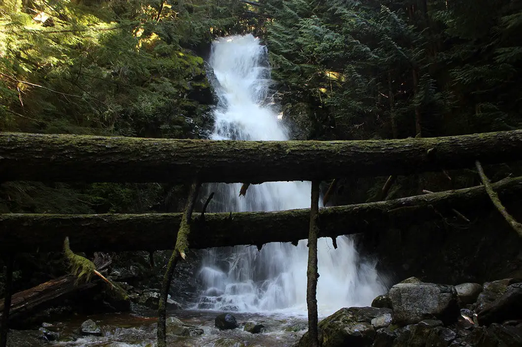
There’s a trail that goes all the way down to the bottom of Sawblade Falls. There isn’t a lot of space down there to stretch out and enjoy lunch, but you’ll get a great view of the water of Coho Creek pouring over the forty-foot falls.
Download the PDF version of this guide for offline use
After you’ve checked out Sawblade Falls, backtrack to the Upper Falls junction. It says Upper Loop/ Harper Road. Follow the trail downhill, to your left. There are orange tape and blue markers on the trees to guide you.
The Upper Loop Trail drops down. You will come to a junction with the connector trail to Lower Loop. Stay left, on the Upper Loop Trail.
The trail keeps winding its way along and across two more streams. You will come to a junction for another connector to the lower trail. Go left again, staying on the Upper Loop Trail.
Follow the trail down for roughly twenty minutes. Eventually, you will come back to the powerline where the Lower Loop and Upper Loop converge.
You will see the remnants of an old trail to your right, which you can ignore. Go on the newly established trail to the left marked for ‘Woodland Walk (Harper Loop)’ with blue flagging.
You will reach the dirt road you were on earlier, and you can go left. You’ve now completed the loop and can retrace your steps the rest of the way back to your car.
Directions and Parking
Take Highway 1 east from Vancouver. Take exit 44 for United Blvd and continue onto BC-7B (Mary Hill Bypass). Turn left onto Broadway Street. Broadway turns into Coast Meridian, keep heading north. Follow Coast Meridian to near its end and turn right onto Harper Road. Harper Road will turn to the left and you will come to a yellow gate on your right. Park on the side of the road near the gate.
Google Map directions are here.
Other great hikes in this area
- Coquitlam Crunch(easy)
- High Knoll (easy)
- Munro & Dennett Lake (Moderate)
- View all hiking guides here


Taylor
Does anyone know if this hike to sawblade falls is still open due to Covid-19 as of today? April 3rd/2020?
David
Hi Taylor, did you ever find out? I plan to take a visit
Serena
Hi David, did you find out? It is now July 31st and I plan on going but i’m not sure if it’s open.
Fred
Well
I am in a meet up group. This hike came up and I am not sure because i am both on blood pressure meds and 225 m could be risky but also I don’t like the bear aspect. I am mixed about whether to go because at 60, I have too much to lose if either of those risk potential happen
Karl W
Hi Fred. I wouldn’t worry about the bears, especially if you are with a group. They’ll leave you alone (of course be prepared that you might see one or two, but I wouldn’t let that deter you). As for the elevation gain and the blood pressure you should definitely check with your doctor. Good luck!