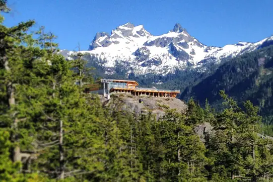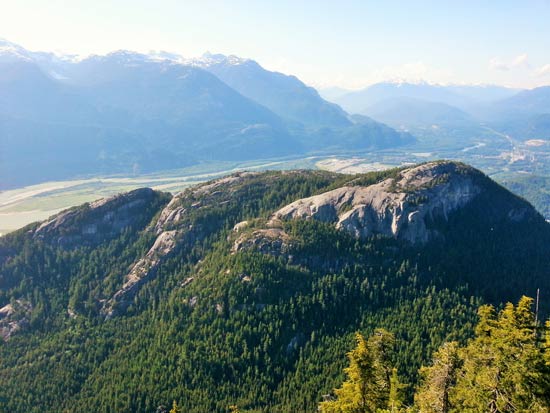
Located in Squamish, the Sea to Sky Gondola opens up access to new terrain and hiking trails in Stawamus Chief Provincial Park. Nestled between the already busy Stawamus Chief and Shannon Falls attractions, the gondola has been hugely popular since its opening in May 2014. Squamish has long called itself the ‘Outdoor Recreation Capital of Canada’, and the gondola only helps to reinforce this image. The gondolas take you up on a 10-minute, two-kilometer ride to the top – 886 meters above sea level.
Here’s a look at some of the hiking trails and other activities you can explore.
Hiking the Sea to Sky Gondola Trails
There are numerous hiking trails at the Sea to Sky Gondola. The high elevation routes (Habrich, Skyline, Sky Pilot) will be under snow until later in the summer. Outdoor Vancouver will be posting trail guides for these three hikes soon and map of all the trails can be found in the Resources section at the bottom of this post.
1) Sea to Summit Trail
Rating: Moderate
Distance: 7.5 km one way
Estimated time: 3-4 hours
Elevation Gain: 835 m
Piggy-backing the existing Stawamus Chief and Upper Shannon Falls trails – the Sea to Summit trail will take you from the parking lot to the Summit Lodge. The trail is very well marked with ‘Sea to Summit’ markers – 400 of them to be exact – starting at the base, going to the top. Starting at gondola ‘Basecamp’, you’ll follow the trail across Oleson Creek connecting to the Stawamus Chief peaks trail. Climb up the steep trail until you soon reach the connecting trail for Upper Shannon Falls. Following the Upper Shannon Falls trail beyond the upper falls, you’ll come to a junction. Stay on the marked trail (heading to the right) for Sea to Summit trail from here.

2) Shannon Basin Loop Trail
Rating: Moderate
Distance: 9.7km loop
Estimated time: 2-3 hours
Elevation Gain: net gain 474m, 292m loss
The Shannon Basin Loop trail is a connecting trail between the Sea to Summit Trail and the Skyline Ridge trail.
If you were hiking from the top you could start out on the Skyline Ridge trail and drop down onto the Shannon Basin Loop trail to then connect up with the Sea to Summit trail making for a nice loop. Or, if you were hiking from the bottom going up the Sea to Summit trail, you could take a right onto the Shannon Basin Loop to Skyline Ridge, making for a longer ascent to the summit
3) Al’s Habrich Ridge Trail
Rating: Moderate
Distance: 7.9km return
Estimated time: 4-6 hours return
Elevation Gain: 354m
This backcountry route will take you to the summit of Mount Habrich, and promises some of the best views in the area – views of the Stawamus river, Howe Sound and Goat Ridge.
4) Sky Pilot Valley Trail
Rating: Moderate
Distance: 8 km return
Estimated time: 3-4 hours return
Elevation Gain: 380m
This route takes you into the valley that lies between Mount Habrich and Ledge Mountain and to the base of Sky Pilot mountain. From there, experienced mountaineers/ climbers can carry on if they wish.
5) Skyline Ridge Trail
Rating: Difficult
Distance: 24 km return
Estimated time: 6 – 8 hours
Elevation Gain: 700m
The Skyline Ridge trail takes you up to the ridge that lies between Sky Pilot massif and Goat Ridge. Provides views of Mount Habrich to the north and the alpine of Sky Pilot and Co Pilot Mountains.
Walking Trails
If you’re just looking for some short walks to stretch the legs out a bit, there are also two walks located directly at the top of the gondola which are open year-round. The trails are groomed and relatively flat making them accessible for everyone (and strollers). There are also free guided tours that leave daily at 11am and 2pm (meet at the lower deck of the Summit Lodge).
1) The Spirit Trail
Rating: Easy
Distance: 400m
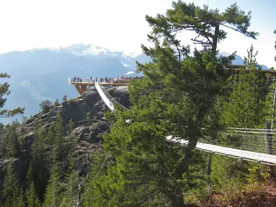
This trail starts at the other side of the Sky Pilot Suspension Bridge and is a quick loop. From the patio of the chalet, walk over the 100m Sky Pilot Suspension Bridge. You’ll see the sign for the trail. It will loop around back to where the gondolas unload, and along the way there are interpretive signs explaining the history and features of the surrounding area.
2) Panorama Trail
Rating: Easy
Distance: 1.6km
This loop takes you through the woods and to several viewpoints. Best of which is the Chief Overlook Viewing Platform, where you will get a view of the Stawamus Chief like you’ve never seen before.

Other activities
Activities aren’t limited to hiking and walking atop the Sea to Sky Gondola. Other activities you can enjoy are:
- Rock Climbing
- Mountaineering
- Snowshoeing
- Ski Touring
- Mountain Biking (trails to be added in the future)
- Suspension Bridge
- Summit Lodge (with 6,000 square-foot-deck, restaurant and gift shop)
Fares, Directions and Parking
Directions: Take Highway #99 heading north past Horseshoe Bay towards Squamish. As you near Squamish, watch for the signs for Shannon Falls and the Sea to Sky Gondola (they’re hard to miss), and simply pull into the lot right off the highway. A Google Map is here.
Parking: There are a few options. Park directly at the gondola basecamp for free if you are staying under 3 hours. There is overflow and long term parking at Darrell Bay (to the south across the highway from Shannon Falls) and Chances Casino (to the north), and a shuttle operates for these lots on weekends and holidays.
You can also park at the parking lot for the Stawamus Chief Provincial Park, or at the parking lot for Shannon Falls. If you are hiking up the mountain, Shannon Falls or the Chief are great places to start from anyways as you’ll begin your hike on the Backside Chief Trail.
Prices and Passes: A day pass is $37.95, or you can hike up and buy a one-way download pass for $9.95. A summer season pass is $99. And dogs are welcome (download only) – Buster can go down on the gondola for $10. There is pricing for children, families, and seniors too – check the website for current details.
Related Posts


Neil V
Another great article, thank you!