Skookumchuck Narrows – Table of Contents
- Hike Introduction
- Skookumchuck Video
- Hike Statistics
- Hike Map
- Hiking Route Description
- Directions and Parking
- Free PDF Download
Skookumchuck Narrows Intro
A B.C. Provincial Park, Skookumchuck Narrows is located in Egmont on the Sunshine Coast. The park was established in 1957 and is home to one of the coolest phenomenon you’ll find anywhere in British Columbia; the mighty Sechelt Rapids. The word ‘skookumchuck’ itself comes from the Chinook language and means ‘strong water’. To say the water is strong is putting it lightly.
Skookumchuck Narrows, aside from being incredibly fun to say, is a beautiful little park which offers a nice hiking trail, fishing, scuba diving, and for the adventurous – kayaking the rapids. It is a great destination for a family day trip or weekend outing.
True to the Sunshine Coast, Skookumchuck Narrows Park has plenty of marine life. On my trip I saw several, massive sea lions playing in the currents. Orcas and porpoises can also be seen if you’re lucky, along with the usual suspects of the tidal pools; crabs, urchins, sea stars, oysters, clams, mussels, etc.
Camping in not available in the park, but there are resorts in Egmont itself (like the West Coast Wilderness Lodge and the Back Eddy Resort).

Skookumchuck Narrows Trail Video
Here is a 2-minute video of our experience on this hike!
The Sechelt Rapids
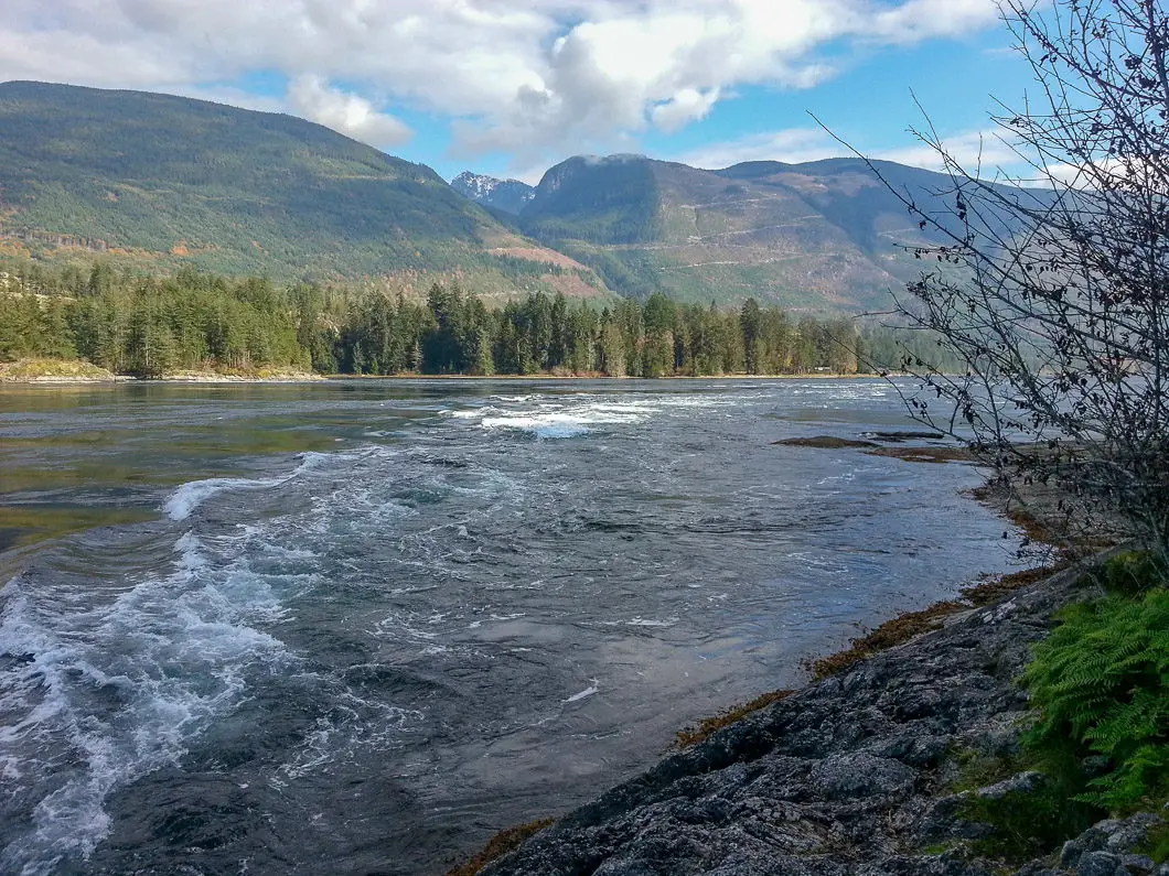
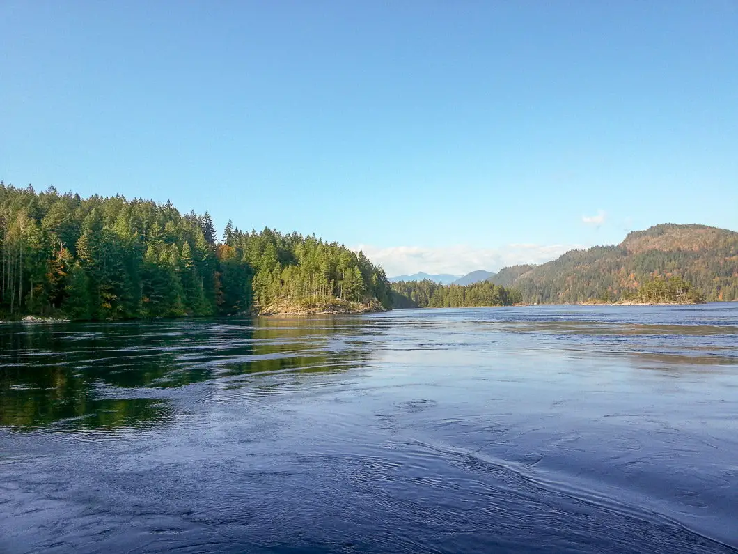
What makes the Skookumchuck Narrows Park one of the biggest draws to the Sunshine Coast is the Sechelt Rapids. Four times each day as the tide changes, an incredible torrent of water pours through the narrows between the Sechelt Inlet and the Jervis Inlet.
The stats from B.C. Parks give you an idea of the enormity of the rapids: “On a 3 metre tide, 200 billion gallons of water flow through the narrows connecting Sechelt and Jervis Inlet. The difference in water levels between one side of the rapids and the other sometimes exceeds 2 metres in height. Current speeds can exceed 30km/hr. The rapids are famous for their spectacular whirlpools and whitewater.”
The only faster tidal flow in the world is in Norway, called Saltstraumen. To see these currents in person is incredible. You have to have the timing correct however, as the rapids only kick up during the tidal change (about 1 hour on either side of the change). You can see a PDF of upcoming tides here.
For the hour or so that the rapids are active, you will likely get a show from kayakers riding the surge. To get to the Sechelt Rapids, you take a leisurely hike through the woods along the Skookumchuck Narrows Trail.

Skookumchuck Narrows Trail Hike Stats
Rating: Easy
Distance: 8 km
Net Elevation Change*: 40 m
Highest Point: 77 m
Time Needed: 2 hours
Type: Out-and-back
Season: Year-round
Dog Allowed: Yes
Est. Driving Time from Vancouver: 4 hours
Trailhead Coordinates: 49.750085, -123.936376
*For a better understanding of the stats and difficulty rating, check out the Hiking Guides page for details. Always carry The Essentials and fill out a trip plan.
Skookumchuck Narrows Hike Map
Skookumchuck Narrows (one-way)
Profile
Skookumchuck Narrows Hiking Route
From the parking area on the side of Egmont Road, there is an outhouse and an information board. From the parking area, you will walk down through a residential area before reaching the actual trailhead. Once you reach the trailhead you will be on a nice, relatively flat double-track trail. The trail rolls, but there isn’t much elevation change, and there aren’t any technical sections until you reach the junction for Roland and North points.
After about 2 km, you will pass by Brown Lake. Keep pushing on, and before long you will come to a junction for the two viewing locations; North Point (to the left) and Roland Point (to the right). North Point is a quick detour on your left and has a beautiful, open view of the inlet (and the rapids). It is a great spot to have a picnic.
Roland Point (the trail leading to the right) is where you want to go for a close-up view of the rapids. The Skookumchuck Narrows trail here carries on for about 10 minutes to the viewing area, where you will be right on top of the rapids and able to watch any kayakers that may be out there having fun.
If you are with your dog (on-leash only in provincial parks) or children, take extreme caution with them at Roland Point, as the current is obviously not something to mess with. To return simply hike back the way you came in.
Download the PDF version of this guide for offline use

Directions and Parking
From Vancouver, you will need to catch the Langdale ferry at Horshoe Bay. From the Langdale ferry terminal, take BC-101N for about 80 km until you see the sign for Egmont (about 1 km from the Earl’s Cove Ferry Terminal). Turn right onto Egmont road and follow it for about 5.5 km until you see the parking sign for Skookumchuck Narrows Provincial Park.
All told, it’s about 1 hour from Langdale. Click here for a Google Map to the trailhead.


Gary Bruner
We were just there on or about May 15 or 16 of 2018. The walk took us about 2 hours from the Back Eddy Marina where we left our sailboat. On a big tide swing, the kayakers were there; about 3 of them, but the most impressive to us was a young mother; I think her name was Emily, but may not have that right. It was an amazing show and well worth the walk, even for old geezers like us. I am soon to turn 70. It took about 1 1/2 hours to return to the Wilderness Lodge where we enjoyed a drink, enjoying a beautiful view from the large windows.
KW
I have done this hike before, and have seen kayakers surfing the rapids. It is a great easy hike for families with kids, nature photographers, and those looking to see the rapids. For the most part it is a very well maintained trail in and out, and the majority of the trail is very wide with little grade. However, there are a few parts as you get closer to the rapids that can be steep for a short period, and if it has recently rained the rocks, and roots are very slippery. Also, at this point in the trail there are a few spots that collect water and create some good sized puddles. If you are going to do this hike with kids or people with limited mobility I do recommend shoes with good support, grip, and also a walking stick for those few tricky spots. Also, the forest this trail goes through is beautiful with all kinds of wildlife, trees and fungi! A great easy hike for a photographer looking for some beautiful nature shots.
Karl W
Hi KW,
Everything you say is spot-on. Thanks for the comment!