Watersprite Lake Hike – Table of Contents
- Hike Introduction
- Hike Statistics
- Watersprite Lake Video
- Map and Elevation
- Hiking Route Description
- Watersprite Cabin
- Directions and Parking
- Free PDF Download
- 360° Photosphere
Watersprite Lake Hike Intro
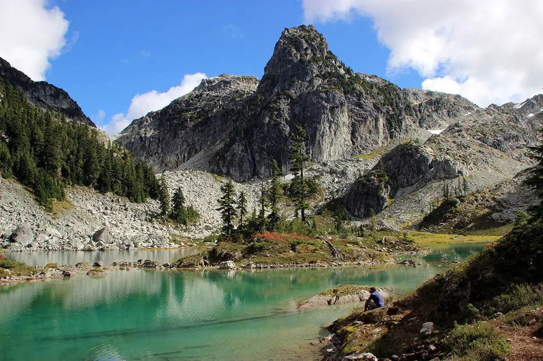
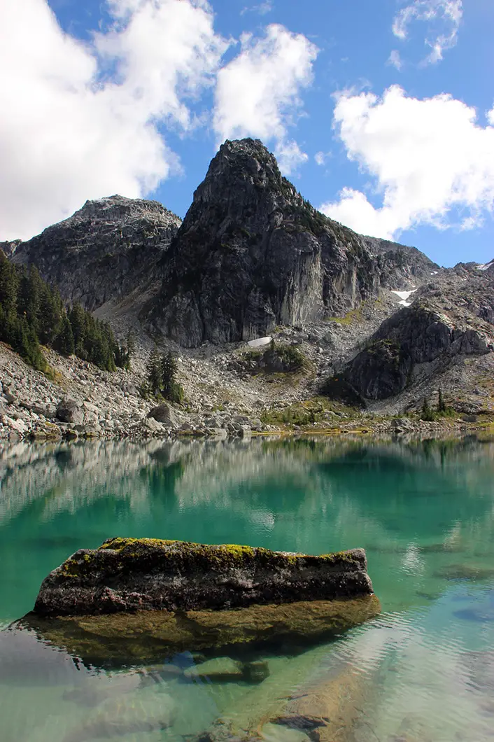
Watersprite Lake in Squamish is a crystal clear, turquoise lake framed by dramatic peaks. It is one of the most awe-inspiring hikes around.
Watersprite Lake was a hidden gem for years. Unknown to most and tucked away down a long, bumpy forest service road. But the word is out and it’s ‘hidden gem’ status has changed.
A new trail to Watersprite Lake has been built by the British Columbia Mountaineering Club. It took several years of legal negotiations with the B.C. Government for the trail to be allowed. There is also a 10-person cabin at the lake available for reservation by BCMC members.
Besides Watersprite Lake, the entire trail up to the lake is full of amazing views. Gorgeous mountains, valleys, and creeks – all along a well-marked and easy to follow route. The new trail offers better scenery, less mud, and bypasses an ecologically sensitive bog. The old route has been decommissioned to protect the environment.
The only drawback to this hike is that it requires a 4×4 or AWD vehicle with good clearance to reach the trailhead.
The route below describes the new route to Watersprite Lake built in 2016 by BCMC. Please note, BCMC continues to build this trail so it may vary slightly now than from when I hiked it in September 2016. There may be new signage and bridges, but the route itself will be the same.
A note on dogs: Dogs are highly discouraged due to the sensitive ecological area around the lake. And please consider that all of everyone’s drinking water comes either from the lake or the surrounding streams. Both at the lake and on the trail. Consider that two of the streams on the trail are crossed twice. Those getting their water downstream may have their water contaminated by dog feces from above. A lot of dog feces has been found around the lake, making it unsanitary for all.
A note on common sense: The Watersprite Lake area is very delicate and should be hiked with leave no trace principles. There are already remnants of rogue fire-rings and campsites. Please camp responsibly. Watersprite Lake has seen a surge in popularity, and everyone will need to hike in responsibly to keep it beautiful and pristine. It is also a backcountry route – so while listed as ‘moderate’ in difficulty, you must be prepared for backcountry travel. There is no cell service beyond the 17 km mark of the Mamquam forest service road. Bears and cougars are in the area. Treat your water.
Watersprite Lake Hike Stats
Rating: Moderate
Distance: 17 km
Net Elevation Change*: 665 m
Highest Point: 1,465 m
Time Needed: 7 Hours
Type: Out-and-back
Season: June – September
Dogs Allowed: Highly Discouraged
Est. Driving Time from Vancouver: 1.75 Hours
Trailhead Coordinates: 49.75222, -122.93432
*For a better understanding of the stats and difficulty rating, check out the Hiking Guides page for details. Always carry The Essentials and fill out a trip plan.
Watersprite Lake Video
Here is a 2-minute video of our experience on this hike!
Watersprite Lake Hike Map and Elevation
Watersprite Lake
Profile
Watersprite Lake Hiking Route
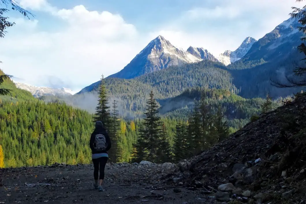
From the yellow gate by the parking area, you will see a gravel road that goes up to your right. On the hill, you will find a trailhead marker which says Watersprite Lake.
Follow the road up and watch for flagging in the rocks. Once you come to the top of the hill you will be on a wide, gravel road. Down to your left, you’ll see the Skookum Dam. The trail carries up to the right. It flattens out and there are wide open mountain views ahead of you. It’s only minutes into this hike and the views are spectacular.
You will come over a little debris field and then follow the flagging that will take you to a flat, dirt road. Follow the trail east. You’ll cross over a wooden bridge. This is Skullhead Creek. After the bridge, the trail narrows and may become muddy.
Keep following the trail over several more creeks. The trail continues through the bush and is easy to follow. The trail will wind its way for another several hundred meters before dropping down into the forest.
The trail becomes more rooty and technical in this area. The canopy of the trees will cover you from above. Before long, the trail begins climbing uphill. There are lots of orange markers and the route remains easy to follow.
After a short climb, you will come out of the trees to a junction. Left is marked for Mamquam and right is marked for Watersprite. Go right. You’ll be out in the open exposure again walking through some bushes. The trail will begin to climb up gradually. At this point, you are roughly 2 km into the hike.
You’ll come to a wooden bridge crossing over the pleasant Skullhead Creek once more. The trail flattens out and carries along. There are a few views off to the right of nearby peaks.
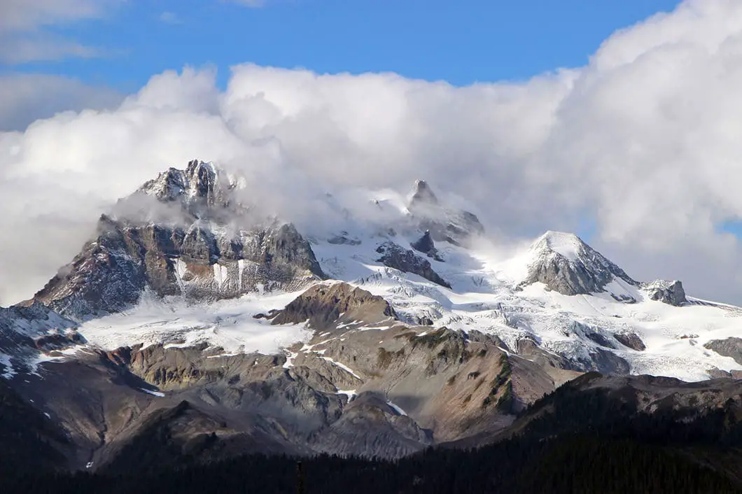
You will cross a few more creeks (there are many on the way to Watersprite Lake). The trail will turn to your right and you will see Atwell Peak looming large in the distance. This is 3 km into the hike.
The trail will suddenly take a hairpin turn to the left and begin climbing uphill. There is another view of a prominent peak directly ahead of you as you climb up the hill.
The trail will switchback to the right and then level off. There are wide open views to your right. Following the trail, you will come to a creek crossing and a small waterfall. There will be a cliff face to your left shoulder. Follow this ridge and you will meet a small rockslide area.
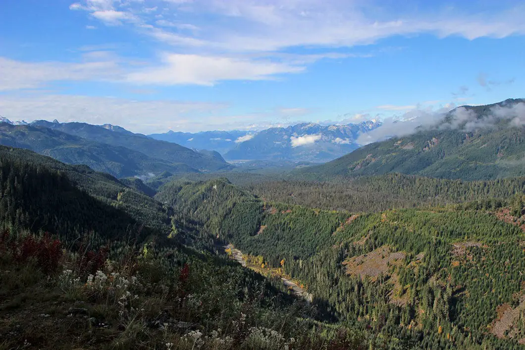
To your right, you’ll have an incredible, panoramic view. This spot is known as the Prow Lookout. On this stretch of the trail, you can see the Skookum Creek Valley below, the Mamquam River, the Skookum Dam, and all the way to the City of Squamish. You can also see many mountains – Atwell Peak, Columnar Peak, Spire Peaks, Pyramid Peak, and even Sky Pilot Mountain to the south. The trail here is flat and enjoyable walking.
The trail will take a gradual turn east. There are not as many markers in this section but the trail is easy to follow. As you carry along this trail with the valley to your right, soon you will see the mountains of Watersprite Lake ahead of you.
The trail will begin to be more rocky and technical. You can see logging roads off to your right. That is where the old route into Watersprite approaches from.
As the trail snakes east, you will come to a large boulder field. You will have to scramble your way across. This section is slow and difficult. But the route is still visible and there is flagging to keep you on track.
After the boulder field, the trail again enters the bush. You will climb uphill a bit. The trail here is rooty, technical and muddy. You will cross Watersprite Creek. While this last stretch is the most difficult hiking, the good news is you are nearly at Watersprite Lake.
You’ll reach a debris chute and at this point, you’ll connect with the original Watersprite Trail coming from the other side. Follow the debris field straight up to the top. To your left, there is a junction that takes you to the Watersprite Lake Cabin. Unless you are staying at the cabin, continue straight to reach the lake.
Dreadnought Peak (1,994 m) is off to the left, Watersprite Tower (1,810 m) is straight across, and Martin Peak (1,877 m) is to the right.
Find a nice spot to sit down and enjoy the views, without trampling any of the off-trail areas. When you’re ready, retrace your steps back to the parking lot.
Download the PDF version of this guide for offline use
Watersprite Lake Cabin
There is a cabin at the lake which was built by BCMC. The cabin will open in 2017. It will primarily be available for members of the BCMC but will also be available for the public to reserve.
More details can be found here.
Directions and Parking
As noted, a 4×4 vehicle or one with high clearance will be needed to reach the trailhead. Drive with caution.
From Vancouver, take the Sea to Sky Highway (#99) north towards Squamish. Just beyond the parking lot for the Stawamus Chief, take your next right onto the Mamquam River Forest Service Road.
Follow the Mamquam River FSR for 13 km, and you will reach a bridge crossing the Mamquam River. Go left over the bridge. There is a pullout on your left. Keep driving and go right over another bridge over Skookum Creek.
After the second bridge, there is a junction. Go left. At the 16 km point, you will come to a junction. You will see a candy cane-shaped vent here. Go left. Going right would take you to the old trailhead.
Please note, the road gets significantly worse for this final stretch to the trailhead. Drive with caution. You will cross a few bridges and reach a yellow gate at the Skookum Dam. Park in the pullout area.
Google Map directions are here.
Other great hikes in this area
- Garibaldi Lake (moderate)
- Black Tusk (difficult)
- Panorama Ridge (difficult)
- View all hiking guides here
Download the PDF version of this guide for offline use
360° Photosphere (click and drag to look around)


Chris
Just finished today. Great hike. Bit of a haul if you, like me, are not fully in shape. 5 hours up, 4 down. Overnight camping great. Snow at top; lookout for postholing as you go from cabin area to tent sites. No bugs on trail; bugs tolerable at tent site
Nelia Willis
I completed this hike on Aug. 4, 2020 and it is a spectacular hike. However, the distance is not 17 km. It is actually 20.4 km from the parking lot to the lake and back. I clocked this distance on my GPS routing watch. In this article under, “Watersprite Lake Hike Map and Elevation” you will also see that the distance is 20.4 km.
Jolene Milan
Found a raincoat and t-shirt on my way down from watersprite this morning if anyone lost em just let me know what they look like so they’re going to the right person! (Sorry not sure where else to post this but the hike was amazing and the review super helpful, much thanks to everyone for the work up there and for creating this review!)
Wayne
Thanks Chris. Kudos for your trial work
Ray O
HI Karl. Thanks for your detailed hiking guide. We consider your website as a great service and always use your information to plan our hikes.
Some feedback regarding this hike: We hiked Watersprite Lake yesterday and it took us about 5.5 hours going and 4.5 hours coming back., a far cry from the estimated 7 hours return that we were expecting. We used an app to track our distance and elevation and total ascent was 784 meters. It was a hot day for a hike (31C) and most of the trail is on a West exposure without forest cover. It also took us a good 1.5 hours to drive through the Forestry Service Roads from the Sea to Sky Highway in our SUV. We were surprised to find a Honda Civic and a Toyota Camry that made it to the parking lot at the trail head!
We personally would describe this hike as difficult. At first we thought we were the only ones having a difficult time but we met up with many young ones (in their 20s (about half our age or more) and almost all of them said that would agree that the hike is a difficult and not moderate as advertised. We were worried about our return trip and didn’t linger long enough to enjoy the lake due to the time constraints. We felt that it would be unsafe to hike through the three boulder fields and the rooty rocky technical and steep sections on final 25% of the hike in the dark (last 2 km) so we safely hiked through that section before sunset . We encountered four parties at and after sunset on our hike back and most of the them didn’t realize how difficult and slow the last 25% of the hike would be. We hope they all made it safely to the lake.
We would greatly reconsider this as a suitable day hike given the amount of time needed to reach the trail head by car and the amount of time to hike to the lake and back. We’ve hiked to Elfin Lakes and Garibaldi Lake before and your guide is right on the money for these ones. Hopefully in the future, the roads and trail to this beautiful lake will be improved so more people can enjoy it for a day hike.
Thanks again and happy hiking in beautiful BC everyone!